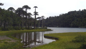
Plantilla:Huerquehue Lagoons
De Wikiexplora
The walk portion of a zigzag climb sharply in the shade of a beautiful forest of tepa, coigües and peanuts. The path is perfectly clear, as the entire stretch from the parking lot to the lagoons is popular in summer months. After about twenty minutes of climb we reach the CONAF booth, where you must register and verify that it has paid for a ticket. The road is continuously rising. After about 40 munutos is reached the fork to the Eagle's Nest Falls. Then they should continue to rise, passing through the small lookout Lake Tinquilco
. Then they must pass the turnoff to the waterfall Trafulco (must get to observe). After the second viewpoint, to 1094 meters, the trail increases the slope always zigzag. After about an hour from the Cascade Eagles Nest is reached beautiful Lake Chico. It has reached the plateau of Huerquehue, and thereafter the route becomes rather flat, with gentle ups and downs in the middle of a forest and Araucaria coigües. He must cross a narrow stretch of the Lake boy by a wooden bridge and then around the lake for a nice stretch along the east coast of the lagoon. Just after crossing a tributary of the lake (the stream that drains the lake El Toro) a fork. It should be right. Do not take the path that goes to the left, pointing to "Laguna Verde". Then you come to a pleasant and scenic peninsula on the southwestern tip of Lake El Toro (on the map marked as "first peninsula"). Good place for lunch and take a bath. Then she must undo a few yards and re-take the main path towards the right, to skirt the Bull. After about 20 minutes from the first lace, you reach the north end of the lake, marked on the map as "fourth lace, a quiet area of reeds and bower. We must continue to the main path, ignoring a path CONAF closed today leading to the Laguna Seca and Escondida. You must climb a gentle slope area, continuing northward. Gaps have been finished by now, and the footprint is still surrounded by Araucaria. After about 25 minutes from the fourth lace, you reach an open area. Here there is a wooden sign with a map and a fork. If you follow the right and carry on towards the Crossing of the Huerquehue Park, if you take the path to the left, begins the road back to finish the circuit Huerquehue Lagoons


