![]()
GPT07 - Laguna Dial


| All GPT sections (click to show) |
|---|
|
GPT Section Articles
|


Recent Alerts and Suggestions
Season Section Log
Summary Table
Satellite Image Map
Elevation Profile

Section Planning Status
Recommended Travel Period
Benefits of Hiking and Packrafting
Recommended Travel Direction
Section Length and Travel Duration
Suitable Section Combinations
Section Attractiveness
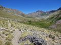
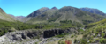
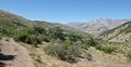
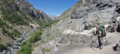
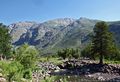
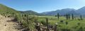
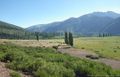
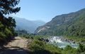
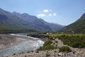
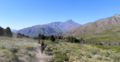
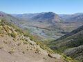
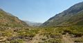
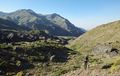
Thissection of the Greater Patagonian Trail leads in four to five hiking days through the wide open valley Melado to the crystal clear Laguna Dial. This lake was formed by a volcanic eruption that plugged the upper valley and transformed this part of the river into a long lake.
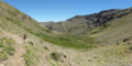
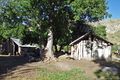
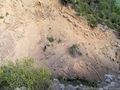
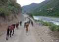
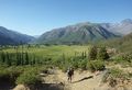
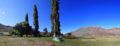
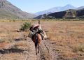
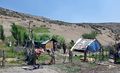
With the melting snow in spring and early summer herdsmen migrate up the valley with their animals. Occasional lush green patches intermigle with vegetation that struggles with the try soil. But the now visible life and the accompanying river Melado make a refreshing change after having crossed the death beauty of volcanic ash and lava in the week before on section 1. Don’t miss the puesto of Señora Irma, where you can eat fresh goat cheese with bread that was recently baked in the hot ash of a fire.
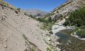
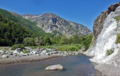
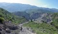
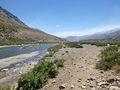
After having passed the deep blue Laguna Dial you descent through the now tighter but equally scenic valleys of the rivers Rió Rodriguez and Los Sauces to the small settlement Pichi Rincon and a place called El Ingles. Here you can take a bus to the small town San Fabian to take a rest and to resupply.
Section Difficulty
Resupply
Resupply Town
Shopping: Food
Shopping: Fuel
Shopping: Equipment
Services: Restaurants
Services: Laundry
Services: ATM and Money Exchange
Accommodation: Hostals and Hotels
Accommodation: Cabañas
Accommodation: Camping
Transport: Ground Transport
Transport: Ferries
Transport: Shipping Services
Resupply on the Trail
Location, Names, Available Items and Services
Access to Route and Return
Access to Start
Return from Finish
Escape Options
Permits, Entry Fees and Right-of-Way Issues
Regular Route
Regular Hiking Route
Regular Packrafting Route
Optional Routes
Investigations and Explorations
Links to other Resources
Alerts and Logs of Past Seasons
Images
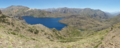
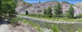
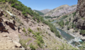
Laguna Dial
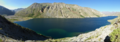
Laguna Dial