![]()
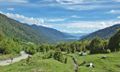
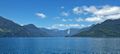
GPT21 (Lago Todos Los Santos)
Add a new log entry always on top in the appropriate season sub-chapter and use format:
* Start Date to Finish Date (use Format YYYY-MMM-DD) / Duration in Days / Hiking or Packrafting / Travel Direction (SOBO for Southbound or NOBO Northbound) / Chosen Route and/or Option Name (RR for Regular Route) / Names or Alias
Summary with remarks to route that are considered useful for other hikers and packrafters. Include alerts, suggestions and personal perception of attractiveness and difficulties.
Add a sub-chapter by placing two "=" before and after the new sub-chapter heading ('==Sub-Chapter Heading==').
Contenido
Section Log, Alerts and Suggestions
Season 2025/26
Season 2024/25
Season 2023/24
From 2024-02-26 to 2024-02-27 // 2 day // Hiking // NOBO // RR + OPT1 // Quentin Clavel
From Cochamo it's 15 long km on the asphalt road then 10 km on the gravel road and finally back on a nice trail (few cars stopped to offered me a ride while I was on the gravel so it seems easy to skip the first section I guess). I slept at the lake todos los santos with an amazing view on the volcano puntiagudo.
Arriving at the beach you'll see some big houses. It's like a lodge for rich people. I met Maria at the beach and explained the situation. I think she's Eduardo's wife, who was not there at the moment.
She knew that I haven't got any other choice for cross the lake and it was difficult to negotiate the price. So it was 80,000CLP for the crossing. It's was pretty late on that day so we agreed to make the traverse at 8am the day after. I slept next to this amazing lake, then the next morning, as we've dealt, I have been driven by Georgio, Maria son's.
80000clp is really painful, but the scenery of the traverse is absolutely amazing ! Georgio letted me at "El Rincón" where the trail continues.
Trail was in ok condition and easy to follow. I met Rudy's son with three horses on the way, then rudy's wife around the settlement. I continued my way until a point where there's a sign "thermals 2km" PK21,72. It's the junction with variant A. Take the junction. I followed the RR on the right, but it was a mess at the end (bushbashing+crossing river).
Few kilometers after I met Alejandro, who has his house there and his own termas. He's a very nice guy, but as the weather wasn't nice and because it was early and I wanted to continue and go on, I didn't stopped to have a bath.
The thermals camp just after Alejandro's house is very nice. There's toilet, flat and nice place to set up the tent and it's next to the river, pretty cool one.
Then, bc the weather was getting worse and worse, I took the option 1 to Laguna Los Quetros. A bit sad to miss the climb of Cerro Cenizo and its apparently amazing view on volcàn puntiagudo, bit it is what it is. The track was well marked, obviously muddy BC of the big rain that I had that day, but still less bad than on some part of the GPT22 (If you're going SOBO that's just a warmup 😜).
Arriving at las gaviotas at the end of the day.
- 2024-Jan-31 to 2024-Feb-02 / 2 days / Hiking / SOBO / {21-01} - RR - {21-A} - RR - ferry(Petrohué) / Lilian
From the comments for ferry transportation, looks like need 100k-140k for one way, and I'm not sure is it will be more in 2024, ao i tried the ferry option, unfortunately failed. About the details read the comments below.
I joined 21 directly from 20 at Las Gaviotas (like Martin & Helena at 22/23 season). So i walked {21-01} for starting.
Dirt road walking to km2.9 then becomes trails.
From km2.9 to Laguna Los Quetros campground, trail sometimes breaks into some small trails like branches that going the same place, mostly they'll combine together later. Also trail crossing many tiny streams, easy to collect water all the way. Sometimes it is going in narrow valley tunnel with muddy ground, so maybe it'll be in a very slippery condition in rain or after rain.
Camp$[15.9/682] : Laguna Los Quetros campground. Free because no one there. Beautiful lake and nice camping spot, I'm so happy i camped here! Lot of different types of spots you can choose at here, grassland just beside the lake with excellent views, well covered under trees with good weather protection, beside some brushes for privacy, or camping beside picnic table and fire ring enjoying the night with friends, all these i said you can choose at here!
The trail down to Todos Ios Santos Lake is almost the same condition, but much muddy and lot of up and down after Settler,Lodging,Ferry[23.2/432] when it close to river.
Hot spring[19.2/438] and the refuge is closed, all locked up. I saw some alga is growing at riverbed (means spring nearby), but the water is cold in river.
Km19.95 : junction of RR and {21-A}, a stick with "turn right arrow" there, so i take {21-A}.
{21-A} km1.05 : nice viewpoint(-40.99042, -72.16940) of Volcán Puntiagudo on the tiny hill at your right side, 2min climbing up only!
Km1.35 : a beautiful grassland(-40.99310, -72.16861) for camping just before rejoin RR. Also a stream is following good before you climbing up to the grassland.
Bridge RR [27.1/248] : flat spot can fit 2 tents before the crossing.
Km28.35 : flat spot can fit 4-6 tents under trees just before you going out to grassland. And the grassland(-41.04036, -72.16133) also is flat and beautiful, good for camping!
Km28.6 : go through the gate.
Km29.4 : one more grassland here, but the previous one is better.
Port[29.9/204] : El Callao, i didn't find any good spot at beach, one small grassland just before you go down to the beach, but not too flat, also poops around there. So the best camping spot before the beach i think is at km28.35, under some trees with views of grassland.
From the comments of Martin & Helena, some information at internet, and some conversations from locals at Lago Rupanco, i know there is a ferry called Elizabeth running from Peulla to Petrohué on Monday, Wednesday, Friday and Sunday at November to February. But it need a phone calls reservation by the residents that lives at Todos Ios Santos Lake. I'm not sure it welcome backpackers or not, but i think you can go with some locals when the ferry arrives at your port.
From the schedule i know, from Peulla to Petrohué on Friday is at 8am, so maybe arrive El Callao at 8.30am to 9am. But, i waited at El Callao from 8am to 9.30am, nothing coming or any ferry going on the lake. (So i assume this ferry just running if there is reservations. And you can't book it, because you are just a tourist for them)
Luckily a local drive a small boat to El Callao from Petrohué with some hikers, i asked him about going Cayutué, but he didn't want to go there, and give me a lovely offer take me back to Petrohué with 25k CLP. I accepted, because today is raining and windy, i didn't want to wait at the beach, didn't know is it anything will come, also in a bad weather condition.
I love my rain jacket and the life jacket that the local provide to me when I'm flying on the lake about 30min.
Then i take the bus to Cochamó for GPT22.
For bus schedule:
10:30 Petrohué - Ensenada 1800CLP 20min 11:20 Ensenada - Cochamó 3000CLP 50min
2024-01-23 to 2024-01-29 / 6,5 days / Hiking / WEBO / Option 3, 3B? (Bariloche+), Option 2, 2B, C (Bariloche+) / Natalie & Tomáš
Overview (sorry for the length):
Since the mountains of Bariloche are a bit of a playground of trails, we did a variation of mainly high trails starting from Laguna Guiterezz and onward to Pampa Linda (joining Option 3 midway) and then followed the "Jesuitos/Vuriloche" route to Ralún (Option 2). We had a few short and a few long days to make a total of 6,5 days.
For the Bariloche part we wanted to go Lago Guiterezz -Lago Frey (via optional valley)- Refugio Jacob -Refugio Italiana ( behind which you join Option 3) and out via Lago Ilón to Pampa Linda. However since I banged up my knee I separated from Tomáš. He went on to do the high route as planned from Jacob and I went down the Huella Andina and then back up via the Laguna Azul trail to meet near Laguna Creton.
Re-supply is possible but expensive and with limited variety at Pampa Linda so bringing most of your food is advised. I restocked on bread (5mil for 1kg or 2.5mil for half) some sweets (2-2.5mil) and had a meal (9mil). There is weak wifi at the tourist info stand (sometimes not working at all, sometimes passing through messages, e-mails and even non-interactive websites, the speed was not a function of the number of people trying to connect) and two campsites (1@4mil, no services apart from toilets and water and 1@8mil with shared electricity and showers).
Highlights of the Bariloche part were indeed mountain vistas, Torre principal of Cerro Catedral lurking everywhere the first towo days, rock scrambling and lagoons. The disadvantages were the slow terrain, (a lot of edging on rock/kitty litter dirt/dust on slab/steep tree belaying dirt) and park rules. You have to register online (easy and free, there is a Goodle form on park's website) and register in person at every Refugio (it is free and if they do not see you, you can get away with no registering, we only actually did it once). Camping is free but it can be annoying because of the amount of people concentrating around refugios. Officially you are only allowed to camp near refugios and at certain designated places, but given the number of tent places along the route, this rule is often breached that is often breached. We never bought food from the refugios but that option is out there.
As for the Jesuitas route (Vuriloche) we were lucky because things were dry and therefore the trek was a lot better than expected. The forest walking/mud tunnels felt like Indiana Jones. The biodiversity of mosses and ferns felt like home (West coast of British Columbia) and the valley settler homesteads were picture perfect at times (and smelled like summer houses in central Europe). The trek to Tronador's "Refugio Viejo" was not to be missed and neither were the hot springs near Ford at [101,3/351], if you cam get there around nightime. The passing through the border with the Carabineros was alarmingly easy. They did not check our food (we smuggled a tomato!) and they barely asked any questions, they just took our passports and came back with a stamp (no PDI paper). Don't forget to check in with the Argentinian border patrol before leaving, if it wasn't for Tomáš, I would have had to walk back from the carabinieros because I did not think it was necessary since I never got an entry stamp from Argentina in the first place –I was wrong. The Argentinians made us fill out a piece of paper to show to the Chilians and perhaps communicated with them that we were coming.
Things to note: -The Terrain around Bariloche is very much alpine-like terrain. It is slow and can be dangerous so if you are not comfortable with steep terrain, rock, edging, gullies and possible snow then I suggest choosing the Huella Andina or the regular GPT21 Option 03 (it iw comparable to GPT11-GPT12 around Cerro Dedos or the ridge at the end of GPT08). -The mud: it is said that in the wet season or after a recent rain the trail on the Jesuitos route gets so muddy that it may be impassable. From what we saw, most of the mud tunnels were very dry so I think it would take a hard rain to make it impassable. -The mosquitos were a thing but we were only "swarmed " in our camp spot on the other side of Cayute(amd we built our tent once for lunch against them). Horse flies seem to be dying off but they were crazy around the Caribeneros. - Option 2C on the North side of Rio Blanco is not meant for pedestrians, there is a sign saying for pedestrians to stay on the Right (South). Maybe it is because of the ford over Rio Blanco (one out of the two bridges still exist, the first one on the west side). There is a skinny suspension bridge over the river at the hotsprings (300 m SE from the ford waypoint) but you can easily ford as well. Some of the bridges on osm are broken and nonexistent (will be corrected in spring 2024). - we got a hitch for only the last 4km of the Laguna Cayute road, then hitched slowly to Puerto Varas for food and a rest.
The details:
We started by getting out of Bariloche by a city bus number 41 (0.2 USD per person, goes every 30 minutes, Google maps or Moovit [more precise] has the schedules, you need to have a SUBE card [available at bus terminals] valid in all of Argentina, topping it online is seemingly impossible, in theory there are many small shops that can top it up [they are marked SUBE, the SUBE app has their locations] but we got lucky only at the third such shop) to Villa Lago Guiterezz and then hitchhiking to the southern end of Lago Guiterezz, where we started walking along a very crowded beach and then in-the-evening-decidedly -not-crowded lakeshore to a beach at the mouth of Arroy van Titter. We then walked towards Lago Frey by taking a partialy (it is probably cleared from time to time) overgrown but beautiful valley just south of the main route. It was slow and swampy (cca for 2 km/1 hour but had little people and offered impressive views of Cerro Catedral south and it's towers. Through this we bypassed the Refugio Frey and made our way to the first of many passes near Laguna Schmoll. The way up is simple scrambling anyone can do, but the way down was a mix of slow edging and sand sliding (it is probably a lotnless travelled). We waited until the heat of the day ended to make our way up the second pass above Refuigo Jacob. For this second pass it was easy walking on the way up but the way down was once again slow edging on relatively steep terrain. We registered and camped at Refugio Jacob to have an early start on the next day. The Refugio and campsites were packed and felt cramped.
I had a bad encounter with a log that morning and my knee was banged up so the next day Tomáš and I split. He went on to the high route and I went down the Huella Andina and up again to a meeting spot near Lago Laguna Creton via Laguna Azul.
As for getting down the Huella Andina it was slower than expected but fine, and getting up to Azul was fast but more involved than expected. The last 200vertical meters was low angle slab beside a waterfall, which was fun for going up but maybe not so fun for the way down. The rest of the way to Creton and camping was easy with fun slabby terrain.
Tomáš's report:
I went from Refugio Jacob to Refugio Italiano through Pico Refugio and then to Pampa Linda through laguna Illón. It took me two full days. The warden at Jacob told us that the route to Refugio Italiano was closed due to snow (a lot fell late in spring), so I met noone on the route, though I saw a set of footprints that were at most from the previous day. The route is mostly marked by cairns, sometimes it is invisible and sometimes you can see a painted sign (there is little consistency in terms of shape or colour of the marking) but is easy to follow with a map. The climb to Pico Refugio was easy scrambling. There were bolted rings that you can use to secure a rope but I did not think it was dangerous to climb unsecured. It was never vertical, the holds were good. It took me 10-15 minutes to get through this section of maybe 50 vertical meters. SAC 5 or slightly under. A much less vertical zigzagging route appeared then on that went to a pass still before Pico Refugio. From then on I sometimes did walk on snow but it was soft without any creeks eating it from underneath so I felt safe. It took me four hours to get to Cerro Navidad. The gully from there was mostly under snow for about 300 vertical meters. I went down on the snow until a creek started flowing under it from left. Then I stayed on the left side of the undersnow creek or on bare rocks. Lower in the valley the route was abit eroded and there was even a short (20 metres - SAC 4 at most) fixed rope but it was not too difficult to get down. It was not easy walking though even in the valley, one crosses the stream several times and there are big stones even in the forrest (SAC 3). I took the first OSM route left to Refugio Italiano. It was quite (but not fully) vertical, but easy, I did use my hands and it was fun. It took me four hours from Cerro Navidad to Refugio Italiano, where there were lots (40?) of people at 4 PM.
I continued along the lake, where there was even a section with steps on the stone made out of metal rods (10 metres, SAC 3-4). This part is frequented and so was easy. It continued to be easy until Laguna CAB (though I lost the route several times going up in the forest). I reached the lagoon before dusk. I met two people on the near end of the lake. There were several people on the far end of the lake, where there are lots of mosquitoes, not recommended to camp. There is no trail around the lake - one fords the lake along its shore for about 1 km, it is not deep. I started going up to Cerro CAB. It is steep and was at first muddy but the route is clear enough in the bush and then marked by cairns on the rocky section (SAC 2-3). I reached the pass when it started to be fully dark. I continued the horizontal traverse (SAC 3-4) with a headlamp but 800 metres took me almost 40 minutes so I stopped before the route starts descending (thank god for the InRreach to InRrach messaging, I could let Natalie know I would not make it that night – the n3xt day it took me four additional jours to get there). It was hard to follow the cairns as one just walks on bare rocks with no visible trail whatsoever, sometimes using hands to go up or down a a few metres. There is a nice horizontal miniplateau ideal for sleeping on a warm windless night (no mosquitoes!) with plentiful water from the melting snow.
In the morning, I woke up to a splendid view of Tronador. I went down, at first again using my hands here and there (SAC 4), but not much. Mosquitoes during daytime in the valley, which is actually a pass you reach from above. The climb to the pass at Cerro Cristal is clear trail at first but the last 150 vertical metres is a diagonal upward traverse walking on large slabs or wedges made out of pure granite. Theirs slope is good and I thought it was fun and itnis quite scenic (SAC 3-4). Going down to laguna Creton is steep and the route is sometimes a bit hard to find but it is not too hard (SAC 3) I saw one tent around Laguna Creton and met about six people going my direction to Laguna Illón, where there was dozens of people at 4 PM. Going down I met over a dozen prople either going my way or going up (and then I met Natalie of course).
Altogether, this traverse took me to routes that are not overun with people and are quite nice with lots of views (Cerro Cathedral is a scary darling that has that name for a reason), being mostly above the tree line. However, the route is demanding – you will be happy to cover 1,5 km per hour. It seems many people go up to a refugio, spend the night and go down again, so the aproach routes to refugios are more popular than the connecting traverses between them. These routes seemed to be in quite good shape thanks to that.
From Pampa Linda, we followed the estabilished option, it was not very eventful and took us three days and a few hours. At the border, the carabinieros have a free basic camping there - expect only water and dry toilet, but you can leave your tent with things and go up to Refugio Viecho, which is functional and sleeps about 8 people plus there are several tent places near it. We met a Spanish couple with a guide who would climb Trenador the next day. People go to the border from Argentina for day trips or two day in and out trips, we met several groups and there were four tents for the night. From the border, we would meet one group per day and one settler per day. The route is travelled but not busy (carabinieros do not have horses and probably rotate by helicopter, we saw it the next day).
The hot springs are very clean and have perfect temperature, there are two pools for about even ten people altogether. On the other side of the bridge, there is a new house probably meant for tourists. We did not meet or see anybody so we just used the hotsprings but techically you probably should go and ask the setler about 300 m downstream on the other side of the river for permission. There is water everywhere on the trail even now when it had been dry for a few weeks. I looked for a route that would connect to La Junta in Cochamo and I found a start of a trail, but it might have been nothing and was anyway hopelessly overgrown.
- 2023-Dec-28 / 3.5 days / Packrafting / SOBO / RP + RR (Variant A) / Lauren & Sebastian
TLTR: Very enjoyable section; No mentionable difficulties; Packraft Lago Todos Los Santos in the morning if you can, as wind will pick up in the afternoon; Great chats with the settlers along the way
From Entre Lagos we hitchhiked and took a bus + ferry to wp Ferry {20} [41.9/123] (Las Gaviotas) where we camped. It took us the entire day to get there so we stayed at the campsite right by the beach (CLP12,500 per person - expensive and maybe the other campsite is cheaper, but it was a very nice campsite with good facilities and hot tub if you like that).
We hiked the next day on RP to wp Refuge, Camp $ {21} [19.2/438] and stayed the night. Rudi wasn’t there and the hot tubs were closed. It was an easy hike all the way. There we met Alejandro, Sergio’s son, who mentioned that Sergio doesn’t live in the valley anymore - it’s him and his mother now, so no more beers, but Alejandro speaks fluent English, which made it easier for us to connect :). If you want to get in touch with him, connect through his insta @valleelcallao.
The next day we continued on RR, took variant 21-A and camped at wp Port {21} [29.9/204] (El Callao) right by the beach. We met Rudi there and had a lovely chat with him.
We started paddling early the next day, crossed Lago Todos los Santos in ard 4 hours and went to shore at wp Lake {21} [53.6/200]. We continued to wp River, Camp {21} [61.1/237] (Rio Conchas) where we went into the water again to paddle the short RP upstream river segment and across Lago Cayutue. It was not the best idea to paddle there in the afternoon, as headwinds on the lake were strong. However it’s a short stretch and going back would have cost more time, so we managed, and the landscape from the lake is really amazing. We stayed the night at wp Lake, Camp {21} [64.1/233]. Beautiful place!
We went to the parking lot at wp Settler {21} [63.4/448] the next morning and were offered a ride down the valley by some lovely people, so we hitchhiked to Cochamó.
- 2023-12-12 to 2023-12-14 / 3 days / Packrafting / SOBO /RR / Roman
Hitchhiked from Entre Lagos all the way to the start of the RR. Beginning was a bit overgrown nothing bad but a bit annoying (7km) [in hindsight I wouldn't consider it BB but close before it, still doable and worth it]. Snow stating at 1350m good to hike as soon as you are out the forest. Down the other side: watch the GPS the entry in the forest can be easily missed and trust the GPS. There are some marks in the bark. The point is here: -40.956873, -72.183669. Trust the GPS and after ~100m you will find a "proper" trail (visible easy to follow). Stayed at the Refuge, Camp $ {21} [19.2/438] [Rudi brought some people NoBo with the Boat). The trail from there to the lake is at the beginning for 5k a bit annoying due to a lot of vegitation (no BB). The frist bridge after Rudi is a bit sketchy, i crawled over it, because there is nothing to hold on, some planks ate missing and some are badly damaged [1]. After that the bridges getting better. Pacrafted the next day to Camp ? {21} [52.2+1.0/196]. Startet Packrafting at 02:00 PM pitched tent at 08:00 PM. Conditions where good. Waited for a window of no wind to cross the lake to the other bank. A lot of exit possibilities there a lot more settlers than on the map. Overall it was a quite day; wind was mainly from west. Got on shore here: Lake {21} [53.6/200]. Trail after that easy and beautiful! Hitchhiked to Cochamó from here: -41.316407, -72.273071.
Overall: beginning a but annoying due to dense vegetation (no BB). After that the trail is ok and is good after the crossing. Would reccomend it even if the beginning is annoying and after Rudi also vegetation but the views are worth it!
Contact: https://linktr.ee/RundW
Season 2022/23
- 2023-Feb-14 to 2023-Feb-17 / 4 days / Hiking / SOBO / RR / Martin & Helena
We joined 21 directly from 20 at Las Gaviotas (see our previous comment). The route to the Laguna Los Quetros is well marked with signs and its nice hiking eventhough pretty muddy for us after 3 rainy days. In the beginning it is a minor road that crosses land of local settlers and after some time its getting into the forrest which is really amazing with many ‘levels’ of vegetation. We ended the day on the official campground that is actually free because no one was there just like others mentioned. There is a fireplace and some benches, all covered. Nice beach and views, definitely one of the nicer campsites.
The following day we had only one goal which was to get close to the Lago Todos Santos and ideally arrange transfer for the next day. Again nice trail through the rain forrest. The hot springs are owned by already mentioned Rudi who needs to open them, as well as the refugio, as we found out. There were some Chileans at the time, but we just took a look and continued. There are 2 baths with hot spring water in a wooden chalet.
We continued with option A directly to the second marked settlement (Dos Cóndores - its not correct in OSM), because of previously mentioned price requested by Rudi (130k) and info from those guys at hot springs who were charged 100k, so it didn’t look like it would be possible to get below that 100k price. Spoiler - we paid that anyway 😅. At the settlement km 23.2 we didn’t get any specific answer because the father was away, bringing other tourists the next day with his boat, and his wife or son couldn’t confirm if the transfer will be possible. We stayed in their cabin for 10k CLP pp for a room, but there was no one else staying that day. There is shower with cold water only and kitchen. Camping is 5k CLP pp and they also provide food - classic dinner or breakfast, asado or bread / eggs.
We decided to go in the morning to the port, primarily to ask Esteban for the transfer. The trail is in good condition. You need to turn left before the shelters, before the port, and you will get to a house of a German family who are really kind and helpful. They speak also English. They showed us the way to Esteban through their garden, but its probably possible to get there from the other side / hill. Esteban agreed to take us the same day at 6PM, we asked him around 11AM. The price was 100k.
Another possible option for transfer over the lake - there should be boat called Elizabeth, organized by government for local residents, that leaves from the northern port km 29.9 on Friday at 9 AM. We don’t know about the other days. Rather verify with locals. We know it goes to Petrohué for sure, but with other places it depends on the demand, don’t know how it works really. But its definitely possible to get to the most frequent places. Eventhough its for residents, they don’t have problem with taking backpackers.
Contact: @martin_hanzelka @helenneka
- 2022-NOV-25 / 3 days / hiking / SOBO / RR and OR A / Yannic & Mirjam
We took the bus from Puerto Montt to Osorono. Unfortunately, the morning bus to Lago Rupanco was already gone. There's supposed to be another one at 4:00 p.m. we decided to take the bus to Entre Lagos and hitchhike from there - which wasn't easy. For a long time nobody gave us a ride on the Minor Road in the direction of Lago Rupanco. In the end we got some shorter rides and hiked some parts too. We stayed the first night at Camping Las Nalcas in Puerto Rico. No official camping but it is allowed to set up the tent on the private land for 4000 pesos. Mini market with simple equipment is right next door. Hike to Laguna Los Quetros was easy and well marked. Camping was free because nobody was there. The next day we went on to Lago Todos Los Santos. At S 40.98259 / W 72.16572 there is an arrow pointing to the right. Be sure to follow this to get on Optional Route A, as there is a gate on the main trail that is difficult to overcome. We stopped at Rudy's and asked about the transport. Because of the increased gas prices, he wanted 140,000 CLP for the crossing, which was too expensive for us. We walked on to Esteban and were happy that he offered us the transfer for 80,000 CLP, which we accepted. He also allowed us to camp on the beach in front of the house for free. Lago Cayutué was definitely a highlight for camping so far. All the ways were in good condition, but sometimes a bit muddy. So maybe not that easy after heavy rainfalls
- 2022-NOV-3 / 3 days / NOBO /hiking / RR / Frank
From Cochamo I walked 15KM on the road to Ralun crossroad (see transport section) Basic shop Minimercado El Cruce at Ralun Cross. Then 9KM on a good dirt road with a little traffic to 'Pass 510 metres'. You could probably hitch part of this if you want. After the pass the road deteriorates to a rough track. Cross a log bridge before Lago Cayutue. Beautiful campsite by the lake, one of the best on the GPT so far. On day 2 I walked to Lago todos los Santos & met Eduardo. He lives at the first house you come to NOBO just before the lake. He was busy & his boat was out of the water but agreed to take me for 80,000 CLP. Other houses & boats there are owned by weekenders who are rarely present. I believe Eduardo is your only option NOBO. However he said he is usually there & only goes to town occasionally. The crossing is spectacular with views of Osorno, Tronador & Puntiagudo.
I continued to the camp at the hot spring. The spring is in a locked shed & there is a basic refuge there, also locked. Rudy came by on his horse in the evening to open the shed. 10,000 CLP to camp & use the spring. If you want to be sure the spring or refuge are open then call in at Refugio dos Condores NOBO. Note the location marked for Refugio dos Condores on Openstreetmap which is used by Gaia & other apps is not correct. The location marked on the track files is the correct one. After Refugio dos Condores you cross a small bridge & on a ridge there are two signs saying Aguas Calientes 2KM. Don't follow the track file here but go down left at the signs on a trail, cross a small stream & go up to a meadow with some farm houses. Go out flat across the meadow with the houses on your right, continuing on a trail in the forest. After 1.5KM you rejoin the track file. This is much easier than the track file route (I used the 2019 track file)
Day 3: Pay attention after Pass 830M, there are a lot of switchbacks in the forest & the route is not obvious. Laguna los Quetros is also a very nice camp but I continued to Las Gaviotas. Got the ferry out at 8PM. This unscheduled ferry does not connect to a bus. I walked out 3KM to Entre Rios, cheap camping, cabanas & basic shop. The campsite has tap water & rabbits but no toilet or shower. The entire route has now been cut back, hardly any bush bashing. There are quite a few mud wallows on the track but you can go around them. Part of the route is on sunken trails & it's likely to flood out & be a mudbath after rain.
- 2022-Oct-17 / 2 days / hiking / SOBO / RR / Alice & Florian
We took the bus from Ensenada to Petrohue (every 45 min each day) and spent the day in the park around Petrohue. They are nice few hours walk on the volcano Osorno, near the the lake and in the forest, and the CONAF team is really nice there (kept our backpacks). Then we arranged a boat transfer from Petrohue to Cayutue for 80 000 pesos. You can call Walter (+56999417795) to arrange in advance but we did not go through him in the end.
After reaching Cayutue, the trail is easy to find, a little bit muddy but okay for us after a few days of sun. We slept at the camp # indicated on the tracks. We arrived the next day around 4PM on the intersection between the trail and the road to Cochamo. There was no bus, but hitchhiking was easy. We slept at the hostel Arcoiris. It is quite cheap as we paid 15000 pesos per person for a double private room, the kitchen is available and well equipped. You can camp as well if you are not tired of it :)
One another piece of information. The CONAF guys in Petrohue told us that they are planning to maintain and put more signalization on La ruta de los jesuitas. This trail comes from Argentina and crosses the Lago de todos los santos until the Rio Blanco. There you can join the main route of the GPT with an optional route. Considering this information, it will be an additional argument for Jan to change this optional route to the main one.
Season 2021/22
- 2021-Dec-13 / 4 days / hiking / NOBO / RR / Molly and Melissa
We took the bus from Puerto Varas towards Cochamó, but got dropped at the road about 15 km before and started directly on the gravel road. The bus leaves quite a few times, but you have to ask around for the specific times. We took it at 13, and I think it left at least once more that day. The employees at the different outdoor stores know pretty well where the bus leaves from and who to ask. We camped at the spot marked "camping" near a small lake, it was quite nice, near a river as well. We got to Lago Todos Los Santos around 13 and asked at the first house marked on the GPS. It's situated on a hill behind three newly built vacation houses. Eduardo who lives there came out as soon as the dogs started barking, and was immediately ready to take us across the lake. The place where you want to get dropped of is called El Rincón. We were charged 70.000 pesos like other people have said as well. On the second day we camped right after the first "bridge" waypoint. Termas: The third day we went to the termas. On the way there, you pass Rudy's house - it's about two hours before the termas. They have a cabin which is about 8000 CLP and sell breakfast, lunch and dinner as well as bread, honey, eggs and so on. They also have the option to camp at the termas which is 7000 CLP for camping and access. They have a wooden tub in a small shed, so you need to get the key from them - easiest going nobo as you pass their house. We later found out that there is a second option. A guy who lives in the house right next to the termas has made his own, it's more natural looking with rocks, and it's outside and more private. You have to knock on his house for him to show you. We actually thought it was nicer, but didn't hear the price. He is also a really nice guy who offers trips to Cerro cenizas with great views of Volcán Puntiagudo if he has time. It's a one day trip according to him. The last part of the trail to Las Gaviotas was fairly easy, although with a lot of confusing trails that ultimately seem to go the same way. Las Gaviotas: In Las Gaviotas there are a few different options for sleeping. There seem to be two or three different people with cabañas, there's a nice camping ground right on the beach with toilets, and we saw a tent further down on the beach which didn't seem to bother anyone. There is a very small shop in a shed on the beach with a few snacks and sodas, and it's possible to buy some bread, eggs and honey but definitely no resupply options. The beach was beautiful and good for swimming! Access/exit: The ferry to Puerto Buey leaves right from the beach every day except Tuesday and Saturday, and costs 200 CLP as previously written. It leaves around 7-8 am and probably some other times as well, we took it Friday at 14 and we saw it leaving twice in the evening Thursday. Puerto Buey is even smaller than Las Gaviotas. The bus left from Puerto Buey (the shed where you get dropped of by the ferry) directly to Osorno at 15:30. We were told that the morning ferry matches a bus that only goes to Puerto Octay, but maybe there are more buses from there. As has been written before, it's possible to walk to Puerto Buey along a gravel road by the lake.
- 2021-Nov-29 to 2021-Nov-30/ 1,5 days / hiking / NOBO / OR: Lago Todos Los Santos - Cerro Cenizo - Volcan Puntiagudo ridge - Lago Rupanco / Alex Abramov
This new variant is not the same as GPT21 option 4: it is easier and more logical. Easy/Moderate difficulty. Rudy Jefi and his refugio are still in business (the price for boat from Petrohue 70.000), but Camping Las Nalcas and Mini Mercado Rupanco were closed.
- 2021-Nov-17 to 2021-Nov-21 / 5 days / Packrafting / Traverse of Lago Todos Los Santos, Option 2 Rio Blanco and Ruta de los Jesuitas (Vuriloche) / Meylin Ubilla and Jan Dudeck
We started this season at Petrohue on the western end of Lago Todos los Santos. Access by bus to Petrohue is easy (Bus from Puerto Varas every 20 to 30 min). Petrohue is a suitable starting point for packrafters that travel southbound with heavier fjord-suitable packrafting equipment.
Lago Todos los Santos: can get very rough with wind but we had two calm days with moderate wind in the late afternoon only. We paddled 40 km in two easy days. Only few of the originally dozens of settlers are still living on the shore and mostly the rich and super-rich of Chile have build vacation homes on the often steep coastline. But since the access to lakes and lake shores is legally guaranteed in Chile, this should not cause a significant problem.
Rio Blanco: 6 years ago we met a settler from Rio Blanco who confirmed that a horse trail traverses this valley and connects to the Ruta de los Jesuitas (Paso Vuriloche). Now we came to investigate and record this route. The well maintained trail includes two river crossings that are well fordable in the morning after some reasonable dry days. Packrafters can cross these fords by packraft if the water level is elevated but hiker may struggle after heavy rain.
Ruta de los Jesuitas (Paso Vuriloche): A well maintained but muddy horse trail connects to Lago Cayetue. Three river generally easy river crossings may become difficult to pass after heavy rain.
Conclusion: Connecting from El Callao to Rio Blanco requires a shorter and more wind protected lake traverse (compared to the current regular route to Cayetue) making it an attractive option for packrafters and southbound hikers if the weather is reasonable dry. I’m considering to change the Regular Route for this option and recommend the route via Cayetue in bad weather only.
El Callao to Cayetue: 22 km on direct route El Callao to Rio Blanco: 14 km on direct route
Season 2020/21
Season 2019/20
- 2020-Jan-04 to 2020-Jan-06 / 3 days / hiking / SOBO / RR / Shaun
I accessed the southbound start of this section by walking 7km east from El Poncho on the dirt road that runs along the south shore of Lago Rupanco (=Oh-Mr-V@20-0a-#001). From settlers Sergio and Sandro, I learned that Esteban is an alternative to Rudy for crossing Lago Todos los Santos. Esteban was able to take me immediately, whereas around the same time Linda (see below) unfortunately had to wait a couple of days. My experience of the rest of section was similar to others’.
- 2020-Jan-03 to 2020-Jan-06 / 4 days / hiking / SOBO / RR / Linda
Starting on the beach of the North shore of Lago Rupanco (arriving from GPT20). Waypoint in Las Gaviotas Food and Lodging is great! Nelly prepared me a big glass of fresh raspberry juice.
Trail to Lago Todos Los Santos is easy and very nice. Only problem = the horse flies that loved me and I had at least 50 around me!
Stop at Las Termas! Beside the cold river, you will find a cabana with 2 bath tubes carved in wood full of hot thermal water. Amazing to camp and rest here.
Next house you will see on the trail is the one of Sergio. Very nice guy. He makes artisanal beer if you want to try one of them!
Then, as mentioned by Martin, in Refugio Dos cóndores, you can ask for the boat transfer of Lago Todos Los Santos to Rudy Jefi. 80000 CLP. I did and had to wait 2 days before crossing.
Other possibility for the boat transfer : when you arrive on the shore of Lago Todos Los Santos, ask the last house on the beach (waypoint = Settler) for Esteban. Same price 80000 CLP but you won't have necessarily to wait cause he seems to be more available than Rudy. Very nice man who offered me food and Lodging before I could cross the lake with Rudy! Say hello from me if you see him!!!
Between Lago Todos los Santos and Lago Cayutué, trail not maintained for about 2 kilometers. Easiest way to overcome the obstacles is to go on the left in the open fields and then go back on the track. Not that difficult but expect to be slow.
Then, after Lago Cayutué, no problem. Easy Hitchiki'g to Cochaml where you will find everything to resupply. Very good accommodation = Patagonia Nativa!
- 2019-DEC-23 to 2019-DEC-24 / 2 days / hiking / SOBO / RR / Martín Lizondo
Trail perfectly walkable. Ask Rudy Yefi in Dos Condores for boat transfer to Pto. Cayuthue (CLP 80.000). After crossing Lago de Todos los Santos the minor road finishes in a 1 km unmantained trail. After 1 km the trail becomes opened and it gets better as you aproach to Laguna Cayuthue. River crossings are easy, less than knee level. From Ralun there’s a bus stop to Cochamó or Pto. Montt.
- 2019-OCT-07 / hiking / Sophie & Hendrik
Refugio Las Termas is a great spot to camp out. Beside the cold river, the hot springs and the fire in the refugio are very nice after a hiking day.
- 2019-NOV-01 / hiking / Sophie & Hendrik
The part between Lago Cayutué and Lago Todo Los Santos is a bit tricky. The last winter(s?) damaged the trail a lot. Rivercrossings are up to knee deep and there is a lot of trees and debris on the trail. In wide parts it is easyer to walk to the right or left of it. Also at one point it is likely that you have to jump/crawl some barbed wire to get around some fallen trees. In some parts it is bush bashing. Expect to be slow in this part.
The river crossing south of Lago Cayutué is easier a little bit further south than indicated by the track files. There is a tree as a bridge.
- 2019-OCT-30 to 2019-NOV-04 / 6 days / hiking / NOBO / RR from one km east of Ralun / Sophie & Hendrik
First day we camped at Lago Cayutué. Second day (to Lago Todos Los Santos) we had bad weather and were a lot slower than expected. (The trail is very damaged in this part, see recent alerts.) Due to health issues we stoped here and went to Puerto Varas for some days. We reentered the trail and only looked for a goat free campsite on our first day back (some 50min of walking). The next stops before we made it to the end of the section were Refugio Las Termas (we highly recommend to take a bath here) and Laguna Los Quetros.
What we liked: Very nice woods, beautiful lakes, very friendly and sympathetic people, crossing Todos Los Santos in an open boat in very heavy rain was harsh but beautiful, the termas, funny animals on the way.
What we did not like so much: In very long parts extremely muddy (probably depends on the season), the trail conditions between Lago Cayutué and Lago Todos Los Santos (which forced us to crawl beneath barbed wire).
Season 2018/19
Season 2017/18
Season 2016/17
Resupply and Accommodation
Resupply and Accommodation in nearby Towns
- Shopping: Food
Cochamó: Possible to resupply out of the several small markets located here but expensive. Some restaurants and many housing options. Minimercado El Cruce at junction with the gravel road in Ralun, very basic. They have drinks, probably wine & possibly pasta. There is a kiosk in Las Gaviotas by the beach with basic snacks & drinks but its opening hours are irregular. On the road 1KM before Ralun NOBO there is a food truck but it only opens in the evenings after 5PM & may be closed in low season. There are no other resupply options along the road Cochamo-Ralun although there are cabanas about every 4KM, some may provide food if you stay there.
- Services: Laundry
A local woman offers a laundry service from her home a few houses down a side street from the main road in Cochamó.
Resupply and Accommodation along the Route
- There is nice camping at the small, scenic Laguna Los Quetros (Km6) near the northern start of the section. At the highly recommended Las Termas, around Km13, there is a small cabana with bath tubs carved of wood and full of hot thermal water. Settlers along the trail are interesting and welcoming.
- 2022 / Yannic & Mirjam
We took the bus from Puerto Montt to Osorono. Unfortunately, the morning bus to Lago Rupanco was already gone. There's supposed to be another one at 4:00 p.m. (...) We stopped at Rudy's and asked about the transport. Because of the increased gas prices, he wanted 140,000 CLP for the crossing, which was too expensive for us. We walked on to Esteban and were happy that he offered us the transfer for 80,000 CLP, which we accepted.
Transport to and from Route
- Southbound and northbound hiking is feasible and recommended. It may be easier to arrange a southbound than a northbound boat crossing of Lago Todos de Los Santos.
- 2023 December / Lauren & Sebastian
Southbound from Entre Lagos to Las Gaviotas:
Hitchhiked from Entre Lagos to intersection south of Lago Rupanco, from there we continued to hitchhike for a bit, but eventually a bus came (around 3:30 pm, CLP 1500 per person, I’m not sure where started though…) that brought us to Puerto Poncho, from there we took the ferry to Las Gaviotas (4:30 pm, CLP200 per person)
- 2023 / Martin & Helena
Another possible option for transfer over the lake - there should be boat called Elizabeth, organized by government for local residents, that leaves from the northern port km 29.9 on Friday at 9 AM. We don’t know about the other days. Rather verify with locals.
- 2022 / Alice & Florian
We took the bus from Ensenada to Petrohue (every 45 min each day).Then we arranged a boat transfer from Petrohue to Cayutue for 80 000 pesos. You can call Walter (+56999417795) to arrange in advance but we did not go through him in the end.
- Access to Start
Northbound: The bus leaves Puerto Montt main bus terminal (07:45, 12:00, 3:30PM & 5PM on weekdays, runs on weekends also but weekend schedule may differ) and travels via Puerto Varas, Ensenada & Ralun to Cochamó. Get off at Ralun crossroads (intersection with a small gravel road near Minimercado EL Cruce) if you don`t want to walk 15KM on the road from Cochamo to Ralun.
Southbound: Ferry Las Gaviotas-Puerto Buey Monday or Tuesday 7:00 & 16:30 Wednesday 2:30 PM, Friday 7:00 & 16:30, Sunday 15:00. Ferry connects with a bus. Buses may go to Entre Lagos, sometimes Puerto Octay or more often to Osorno. Buses every half hour Entre Lagos-Osorno. There should be an unscheduled ferry Las Gaviotas-Puerto Buey Monday or Tuesday, Wednesday, Friday & Sunday at 8PM but this ferry does not connect with a bus. Ferry Puerto Buey-Las Gaviotas Monday or Tuesday 8:00 & 17:30, Wednesday 15:30, Friday 8:00 & 17:30, Sunday 16:00. A bus coming from Osorno outside Terminal Rural goes to Puerto Buey to connect with the ferry on operational days, timetable not known. Ask at info. desk in Osorno Terminal Rural. No bus on days the ferry doesn`t run. Hitching is difficult, there is a gravel road all the way to Las Gaviotas but not much traffic except on weekends. In addition to accessing through GPT20, it is possible to take private transportation on the road that runs along the south shore of Lago Rupanco and walk the final 5-7km to the northern start point of GPT21.
- Return from Finish
Northbound: The ferry to Puerto Buey leaves right from the beach every day except Tuesday and Saturday, and costs 200 CLP as previously written. It leaves around 7-8 am and probably some other times as well, we took it Friday at 14 and we saw it leaving twice in the evening Thursday. The bus left from Puerto Buey (the shed where you get dropped of by the ferry) directly to Osorno at 15:30. We were told that the morning ferry matches a bus that only goes to Puerto Octay, but there are more busses from there.
Permits, Entry Fees and Right-of-Way Issues
Links to other Resources
Retired Section Article GPT21 - Lago Todos Los Santos
Images
thumb|
thumb|
thumb|
thumb|
thumb|
thumb|


