ENG:Cerro Manquehue
| Atención: las restricciones de acceso han sido resueltas. Esta ruta se encuentra ABIERTA en forma definitiva |
|
|
|
| |||||||||||||||||||||||||||||||||||||||||||||||
| De la serie de rutas del Cerro Manquehue |
|---|
|
Por Lo Curro |

Appropriate time
All year. Ideal immediately after a rain, when the air is clean and the mountain range snowy.
Difficulty
An important part of the ascent goes through a slope that gains height quickly. For people without experience or good physical condition this implies a high physical effort, while for people with experience in hills or athletes the level of physical difficulty will be medium. There are zones, with a high slope whose and with compact earth, where many people will have difficulties to pass, nevertheless with some care and help all achieve it.
Access
In vehicle
From the Lo Curro roundabout, take Santa María Avenue towards the east. After traveling a little less than 1 km turn left to take Gran Vía street. This begins to climb the hillside and after 1.5 km you must turn left (there is a sign with a blinking light , a guardhouse and a barrier) to take the Vía Roja street. Follow this for about 500m and turn to the right in a fairly closed curve (it is still the Vía Roja). Then continue for about 800m and turn again, this time to the left (again a sharp turn and that is still the Vía Roja). Continue for 700m and turn again to the right along the Vía Gris, where you continue for another 300m. Finally it turns to the left (via the Vía Roja) to finally advance about 900m and after a bend, on the left, find the pass towards the hill next to the parking lots.
'Note' : There are only 20 parking spaces enabled by the Municipality of Vitacura, so Saturdays, Sundays and holidays in the morning it is very likely not to be able to park. One option is to park a lot lower. The other, take the bus that the municipality has arranged for these purposes (see next section).
In public transport and hitchhiking
There are only buses from Transantiago to the Lo Curro roundabout (Louis Pasteur Avenue with Santa María Avenue) or to Santa María Avenue and Gran Vía corner. The C14 feeder should be taken from the Escuela Militar Metro station.
From the Lo Curro roundabout or from the Escuela Militar Metro station it is possible to take a bus to the starting point, the price from military school at the beginning of the hill is $ 2600 (August 2016)
There are buses of approach facilitated by the municipality, starting from the Unimarc of the roundabout of Lo Curro (nov'16). Schedules at: this link.
Description of the route
From the Vía Roja parking lots (1054 meters above sea level), a wide path to the northwest is made, which goes from the berm of the paved road
At the beginning the slope is rather smooth. A few meters, a wall must be crossed by an existing gap. Then a small clearing appears, and then you must be careful to take some of the trails that twist towards the north, earning more slope.
After 20 or 25 minutes, one should be near the westernmost part of the pass between Manquehue and Maquehuito, where there is little slope and a general view of the area. The Manquehue massif looks imposing from this point.
The second stage of this hike is the ascent of the main massif, along the east edge of the hill, which goes directly to the summit. This sector has a steep slope and some stretches of loose material especially steep, which require support on some roots. Closer to the summit, we advance in some stretches on steeply sloping rock, but which do not require the use of our hands.
The summit is a pleasant flat terrace, which extends longitudinally in an east-west direction. The best viewpoint is the one on the east end.
Expected time
- At a quiet pace, usually take about an hour and a half to reach the summit, and about 50 minutes the descent.
- A person with good physical condition who climbs the Manquehue with sporting character, takes the order of 45 minutes to reach the top, or even less.
Permits / Rates
 |
This route is free and permission is not required |
|---|
Recommendations
- Checklist: Aunque sepas perfectamente lo que debes llevar, es preferible chequearlo al empacar. Esta ruta ha sido clasificada como Type 1 equipment checklist: low altitude route, without camping, snow or cold.
- For many children under 8, seniors or sedentary people, the climb to the top can be a tough challenge.
- There is no water in the whole way. Consider 1.5 liters per person if it is hot.
- Between the portezuelo and the summit the slope is important. In much of this section this only implies greater physical wear, but there are some short sections where the combination of slope and bad terrain (either with loose material or very compact earth) make the passage difficult. To avoid slipping, there are those who use their hands, lean on their knees, or sit up straight. Some good practices are:
- Go with shoes with a suitable sole, avoiding too-smooth sole shoes.
- Use trekking poles (or something similar)
- Choose the route with the least slope, even if this makes it longer.
- Wear gloves on the descent (it does not prevent the fall, but it diminishes its consequences by avoiding scratches)
- Do not carry things in your hands, or bottles, or camera, or anything. Take everything in pockets, backpack, banana, etc. The exception are the canes.
- As always it is necessary to use sunscreen: hat, factor 30 or higher, glasses with UV protection, etc.
- The ideal is to climb a day when the air in Santiago is clean. In this way you can have a spectacular view of the city.
- In recent times there have been several assaults on the hill, so it is better not to carry valuables (it is better to inform yourself as this may change over time, either for better or worse). Suggestion: AVOID being in the MANQUEHUE between 2 and 3 pm on Saturday, due to the high percentage of assaults registered during that day at that time. If you have keys or valuables, bring a banana that you can hide under your shirt! The assailants usually carry mainly backpacks, so one suggestion would be to carry a backpack in which you leave only water and small objects.
- Although this route occupies the eastern edge of the hill to ascend / descend, a route that is not dangerous, not far away is the southeast face of the hill (face that faces Santa María de Manquehue) where you MUST NOT TRANSIT due to the risk of a serious accident. Although the route described here is not difficult to follow, if you have any doubt, you should prefer to walk north (right / left if you go up / down), in this way you avoid reaching that dangerous area. It is very important to be aware of this risk, but it should not be a reason to stop visiting this hill.
- The hill has no schedule restriction, but it is not a good idea to be there without daylight. You have to schedule the visit in such a way to be back in the car before sunset.
- A good security measure is to carry a headlight, even if it is small. In case of any unforeseen event that delays the descent, having light could be a great help to avoid an accident or spend the night on the hill. This is more advisable if you leave a week day (few people) and in the afternoon, perhaps not so much if you leave on a Sunday morning, although it is always good to be cautious.
- If it is your first visit, it is a good idea to go on a Saturday or Sunday morning when there are more people.
Photo Gallery
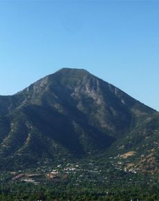
Cerro Manquehue desde el sureste (rutas de Lo Curro y Agua del Palo), inusualmente nevado
Vista de Santiago y calle Agua del Palo. Mirando al sur (ruta de Agua del Palo), 24/4/13
Ascenso con pendiente y tierra suelta (ruta de Agua del Palo), 24/4/13
Descenso ruta Agua del Palo con tierra suelta y gran inclinación, no es recomedable bajar por esta ruta, vea alternativas (ruta de Agua del Palo), 24/4/13
Cumbre del cerro Manquehue vista desde el mirador de la ruta Agua del Palo (ruta de Agua del Palo), 24/4/13
Ruta Agua del Palo, previo a iniciar el descenso. (ruta de Agua del Palo), 24/4/13
Cardos en la zona baja de Los Trapenses
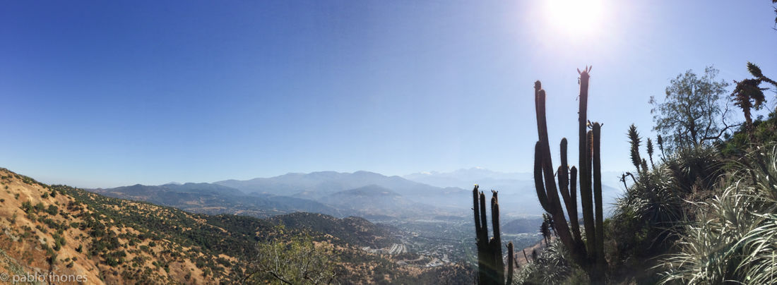
Cactus en flor y vista de Lo Barnechea - 15% de la ruta de Los Trapenses
Revisa la lista completa de 621 rutas de trekking y las 345 rutas de montaña en Chile
|
Videos
- Páginas que usan argumentos duplicados en invocaciones de plantillas
- Articles translated automatically that need human revision
- Indexada
- Imperdonables
- Rutas
- Routes in english
- Montaña
- Rutas de un día
- Montañas de dificultad Muy Fácil
- Rutas gratuitas y que no requieren de permiso
- Rutas con checklist
- Trekking y Montaña en Chile
- Clasicos de Santiago Patch
- KMZconTrack


