Diferencia entre revisiones de «GPT73P - Lago Yelcho»
De Wikiexplora
(→Recent Alerts and Suggestions) (Etiquetas: Edición desde móvil, Edición vía web móvil) |
(→Elevation Profile) |
||
| Línea 159: | Línea 159: | ||
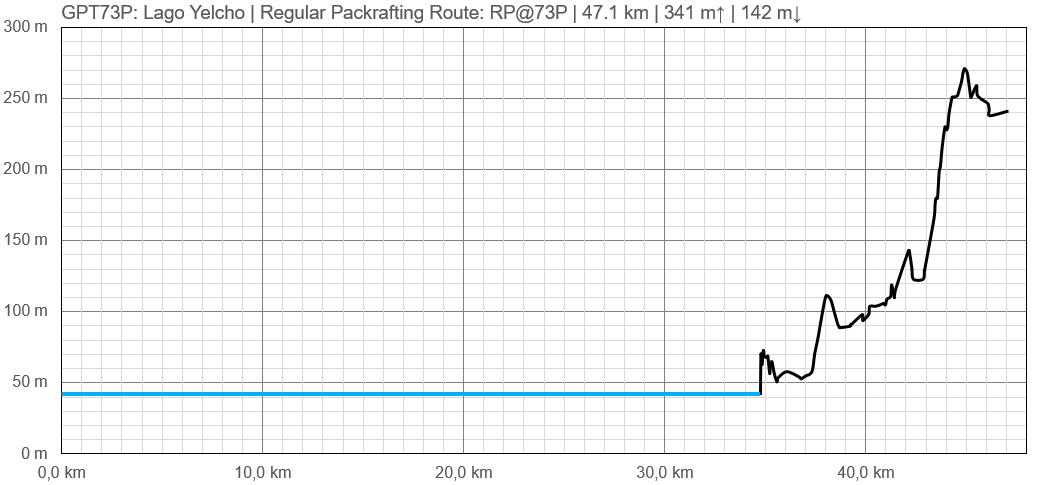
==Elevation Profile== | ==Elevation Profile== | ||
[[File:perfil greater patagonian trail 73P.PNG|frame|center|Profile of GPT73P: Lago Yelcho]] | [[File:perfil greater patagonian trail 73P.PNG|frame|center|Profile of GPT73P: Lago Yelcho]] | ||
| + | |||
==Section Planning Status== | ==Section Planning Status== | ||
==Recommended Travel Period== | ==Recommended Travel Period== | ||
Revisión del 02:54 18 sep 2023
This article is just a draft. You can help by expanding and improving its content
| All GPT sections (click to show) |
|---|
|
GPT Section Articles
|
Recent Alerts and Suggestions
- GPT 73P Lago Yelcho/ Packrafting Route / SoBo/ 2022 Jan-16 / 2,5 days / Tobias Schorcht
While crossing Lago Yelcho I had to think about Jan's words, who characterized the lake as a "Beast", many times! The direction of the wind changed withhin seconds and forecasts were wrong many times. Got stuck on the peninsula right in the middle of the Lake (emergency Camp) for 1 day. For 1 small freestanding tent the camp is fine, if you have a bigger tent, the night will be uncomfortable. The 2 other camps are just amaizing!! I also recomment to visit the 30m waterfall (not on the route) -43,26788, -72,28440.
Season Section Log
Summary Table
| GPT73P: Lago Yelcho | Hiking | Packrafting | |||||
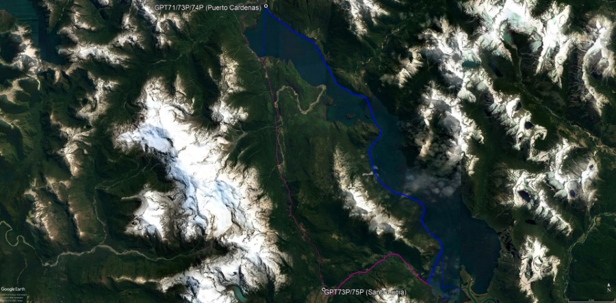
| Group | M: Sector Yelcho | Total | - | - | 47.1 km | 13 h | |
| Region | Chile: Los Lagos (X) | Trails (TL) | - | - | - | - | |
| Start | Puerto Cárdenas | Minor Roads (MR) | - | - | - | - | |
| Finish | Santa Lucía | Primary Roads (PR) | - | - | 12.4 km | 26.3% | |
| Status | Published & Verified | Cross-Country (CC) | - | - | - | - | |
| Traversable | Sep - May | Bush-Bashing (BB) | - | - | - | - | |
| Packraft | Required | Ferry (FY) | - | - | - | - | |
| Connects to | GPT71, GPT72, GPT74P, GPT75P | Investigation (I) | - | - | - | - | |
| Options | 42 km (1 Options & Variants) | Exploration (EXP) | - | - | - | - | |
| Hiking | Packrafting | Total on Water | 34.7 km | 73.7% | |||
| Attraction | - | 4 (of 5) | River (RI) | - | - | ||
| Difficulty | - | 5 (of 5) | Lake (LK) | 34.7 km | 73.7% | ||
| Direction | None | Both ↓↑ | Fjord (FJ) | - | - | ||
| Comment | Hiking: Hiking not feasible | ||||||
| Character | Packrafting: ↓ Preferable due to predominant wind direction | ||||||
| Challenges | Valdivian Rain Forest, Farmland, Lake Packrafting, Road Walking | ||||||


