![]()
Diferencia entre revisiones de «Greater Patagonian Trail»
(→Trail Sections) |
|||
| Línea 1: | Línea 1: | ||
| − | {{ | + | {{Indexed}}[[category:KMZconTrack]]{{RutaForme |
| − | {{ | + | |
|Actividad=Trekking | |Actividad=Trekking | ||
|País=Argentina, Chile | |País=Argentina, Chile | ||
|CiudadesArgentina=El Bolsón | |CiudadesArgentina=El Bolsón | ||
| − | |CiudadesChile= | + | |CiudadesChile=Santiago |
|BellezaEscenica=Impresionante | |BellezaEscenica=Impresionante | ||
|Atractivos=Vistas panorámicas, Glaciar, Bosque, Flora atractiva, Fauna atractiva, Lago, Laguna, Río, Fiordos, Formación Geológica, Cascada, Parque Nacional | |Atractivos=Vistas panorámicas, Glaciar, Bosque, Flora atractiva, Fauna atractiva, Lago, Laguna, Río, Fiordos, Formación Geológica, Cascada, Parque Nacional | ||
| − | | | + | |Duracion=más de 90 días |
| − | + | ||
| − | + | ||
|Sendero=Tramos sin sendero | |Sendero=Tramos sin sendero | ||
|Señalizacion=Insuficiente | |Señalizacion=Insuficiente | ||
|Infraestructura=Inexistente | |Infraestructura=Inexistente | ||
| − | | | + | |ComparteIdayRetorno=Cruce |
| − | |Distancia= | + | |Latitud1=-38 |
| − | | | + | |Longitud1=-73 |
| + | |Distancia=3035000 | ||
| + | |MetrosAscenso=116000 | ||
| + | |MetrosDescenso=116000 | ||
| + | |Comentarios distancia=Regular Route (Hiking Option and Packrafting Option without Exploration Sections) | ||
| + | |AltitudMedia=900 | ||
|Primer Autor=Jan Dudeck | |Primer Autor=Jan Dudeck | ||
| − | + | |Imágen Principal=Greater_patagonian_trail.jpg | |
| − | |Imágen Principal= | + | |ComentariosImagen=GPT16: [[Volcán Mocho]] on the background. |
| − | |ComentariosImagen= | + | |KMLZ=GPT_Minimized_NOT_FOR_HIKING_AND_PACKRAFTING.kmz |
| − | |KMLZ= | + | |
| − | + | ||
| − | + | ||
| − | + | ||
| − | + | ||
| − | + | ||
| − | + | ||
| − | + | ||
| − | + | ||
| − | + | ||
|TipoDeMap=HYBRID | |TipoDeMap=HYBRID | ||
| + | |ComentariosMapa=GPT SAMPLE Minimized (NOT FOR HIKING AND PACKRAFTING) {{colores|red|Trail.}}{{colores|blue|Packraft.}}{{colores|blue|Packraft.}} | ||
}} | }} | ||
| − | |||
| − | |||
| − | |||
| − | = | + | <br style="clear:both" /> |
| − | + | ||
| − | + | {{Table all GPTs}} | |
| − | + | <br style="clear:both" /> | |
| − | == | + | ==Introduction== |
| − | + | ||
| − | + | [[File:GPT01-P0115.jpg|thumb|500px|right|GPT06: The volcanos Descabezado Grande and Cerro Azul with the Laguna Caracol to their feet. Image: Jan Dudeck]] | |
| − | The | + | [[File:GPT08-Arriero.jpg|thumb|500px|GPT09: Arriero at the base of the Vulcano Antuco. Image: Jan Dudeck]] |
| + | [[File:GPT06-P0005.jpg|thumb|500px|GPT11: Araucaria trees in the Pehuenche homeland. Image: Jan Dudeck]] | ||
| + | [[File:GPT13-P0028.jpg|thumb|500px|GPT18: Cross Country walking on volcanic ash at Cordon Caulle after recent eruption. File: Jan Dudeck]] | ||
| + | [[File:GPT28-Rio_Palena.jpg|thumb|500px|GPT28: Packrafting the Río Palena. Image: Jan Dudeck]] | ||
| + | [[File:GPT_Glaciar_O'Higgins.jpg|thumb|500px|GPT38: Glaciar O'Higgins coming down from the Southern Icefield. Image: Jan Dudeck]] | ||
| − | The | + | The Greater Patagonian Trail (GPT) is a long-distance route network in the southern Andes that spans from the outskirts of Santiago all the way to southern Patagonia. |
| − | |||
| − | |||
| − | |||
| − | |||
| − | |||
| − | |||
| − | |||
| − | |||
| − | |||
| − | |||
| − | |||
| − | |||
| − | |||
| − | |||
| − | |||
| − | |||
| − | |||
| − | |||
| − | |||
| − | |||
| − | |||
| − | |||
| − | |||
| − | |||
| − | |||
| − | |||
| − | |||
| − | |||
| − | |||
| − | |||
| − | |||
| − | |||
| − | |||
| − | |||
| − | |||
| − | |||
| − | |||
| − | |||
| − | |||
| − | |||
| − | |||
| − | |||
| − | |||
| − | |||
| − | |||
| − | |||
| − | |||
| − | |||
| − | |||
| − | |||
| − | |||
| − | |||
| − | |||
| − | |||
| − | |||
| − | |||
| − | |||
| − | |||
| − | |||
| − | |||
| − | |||
| − | |||
| − | |||
| − | |||
| − | |||
| − | |||
| − | |||
| − | |||
| − | |||
| − | |||
| − | |||
| − | |||
| − | |||
| − | |||
| − | |||
| − | |||
| − | |||
| − | |||
| − | |||
| − | |||
| − | |||
| − | |||
| − | |||
| − | |||
| − | |||
| − | |||
| − | |||
| − | |||
| − | |||
| − | |||
| − | |||
| − | |||
| − | |||
| − | |||
| − | |||
| − | |||
| − | |||
| − | |||
| − | |||
| − | |||
| − | |||
| − | |||
| − | |||
| − | |||
| − | |||
| − | |||
| − | |||
| − | |||
| − | |||
| − | |||
| − | |||
| − | |||
| − | |||
| − | |||
| − | |||
| − | |||
| − | |||
| − | |||
| − | |||
| − | |||
| − | |||
| − | |||
| − | |||
| − | |||
| − | |||
| − | |||
| − | |||
| − | |||
| − | |||
| − | |||
| − | |||
| − | |||
| − | |||
| − | |||
| − | |||
| − | |||
| − | |||
| − | |||
| − | |||
| − | |||
| − | |||
| − | |||
| − | |||
| − | |||
| − | |||
| − | |||
| − | |||
| − | |||
| − | |||
| − | |||
| − | |||
| − | |||
| − | |||
| − | + | It’s a stunningly beautiful and diverse trail system that guides you from the semi-desert of the Precordillera into scenic Andes valleys. The trails cross numerous dormant and active volcanos with partially healed volcanic scars and fresh open wounds from recent eruptions. You can take a dip in more than a dozen hot springs along the way to draw from this energy. | |
| − | + | ||
| − | + | Continuing, you will dive into the twilight of lush green temperate rainforest lined by snow covered mountains. Numerous passes and high plains get you above the tree line into barren terrain with broad views. Crystal clear rivers descend from these mountains and feed deep blue lakes along the way. If you packraft you can paddle over lakes and float down rivers all the way into the Patagonian fjords where the Pacific Ocean hits the ragged coast. | |
| − | |||
| − | + | Eventually you reach the Southern Patagonian Icefield, one of the world's largest extra-polar Icefields. Here giant rock towers stab into the sky and enormous glaciers calve colossal blocks of ice into wind battered lakes. | |
| − | |||
| − | In the | + | On the northern part of the route you will meet solitary cowboys (In Chile called arrieros or puesteros) with their animals. Every spring the livestock is moved on higher ground to graze on mountain pastures. The trail later crosses the homeland of the indigenous Pehuenche (one of the Mapuche tribes) where majestic Araucaria trees tower above the tribal land and provide the traditional food for these sometimes shy and sometimes proud people. When going further south you will meet courageous settlers that have ventured into the challenging back-country of Patagonia. If you are interested, you can listen to their stories while sitting around the warm stove and sharing the traditional drink of this region: Mate. These authentic encounters are part of the beauty of this trail. |
| − | |||
| − | |||
| − | |||
| − | |||
| − | |||
| − | |||
| − | |||
| − | |||
| − | |||
| − | |||
| − | |||
| − | |||
| − | |||
| − | |||
| − | |||
| − | |||
| − | |||
| − | |||
| − | |||
| − | |||
| − | |||
| − | |||
| − | |||
| − | |||
| − | |||
| − | |||
| − | |||
| − | |||
| − | |||
| − | |||
| − | |||
| − | |||
| − | |||
| − | |||
| − | |||
| − | |||
| − | |||
| − | |||
| − | |||
| − | |||
| − | |||
| − | |||
| − | |||
| − | |||
| − | |||
| − | |||
| − | |||
| − | |||
| − | |||
| − | |||
| − | |||
| − | + | In countless locations the trail branches into different routes creating a wide network of tracks that gives you many choices. You may either walk the entire distance or you can bring a packraft to float down rivers and paddle and sail over lakes and fjords. | |
| − | + | ||
| − | |||
| − | |||
| − | + | There are also various volcanoes and other summits along the route that can be ascended without rock climbing gear. I have also included optional tracks that get you literally into the last valley on the border between Chile and Argentina. These remote corners of the southern Andes are of particular interest to hikers that love to venture into remote back-country. | |
| + | |||
| − | + | The Main Route currently spans approximately 5'000 km and the entire route network (including all options) contains more than 20'000 km of tracks. | |
| − | |||
| − | |||
| − | + | If this introduction quickened your appetite to explore this network of trails then don't stop reading here and don't pack your backpack yet. The GPT is quite different from what you might expect. Especially if you have thru-hiked the famous long-distance trails in the US (i.e. the Appalachian Trail, the Pacific Crest Trail or the Continental Divide Trail) or if you walked on the European pilgrimage trails (i.e. the Camino de Santiago) don't assume that the GPT will be a similar experience and that you are already prepared for it. This region and this route network is unequal in nature. Some best practices and habits that are important on established trails in the US and Europe would be foolish in Patagonia. Other skills and aptitudes are essential to truly appreciate the Greater Patagonian Trail. | |
| − | |||
| − | + | Since I started publishing the GPT, I consulted and surveyed more than one hundred people that attempted to walk major parts of the trail. The majority were absolutely amazed by the land, the people and their experience on the trail. But some hikers quickly aborted or changed their plans. In consequence they missed the best parts of the trail. Interestingly, some of these were experienced hikers and athletic walkers. | |
| − | |||
| − | + | In the [http://bit.ly/GPTguide Hikers Manual] I try to rectify potential incorrect assumptions and outline the essentials for hiking and packrafting on this trail network. You should also read the publications of other hikers and packrafters to learn from the diverse experiences on the Greater Patagonian Trail. | |
| − | + | ||
| − | |||
| − | + | '''Statements about the GPT by Hikers and Packrafters:''' | |
| − | |||
| − | + | Bethany Hughes and Lauren Reed (Fidgit and Neon): "This trail has been the most punishing and the most magical experience of my hiking career to date.” | |
| − | + | ||
| − | |||
| − | |||
| − | |||
| − | + | Piia Kortsalo and Oliver Barker: "We’re filled with incredible memories of our time on the GPT, and the landscape and culture of the Chilean Andes will stay with us forever. While hiking the GPT was an incredible experience for us, we don't imagine this as the right trail for everyone. The GPT is closer to an idea of a route than an established trail; hikers setting out expecting a well-organized, continuous, marked hiking trail will inevitably be disappointed. The GPT really is a route for a very specific sort of hiker, one who's as interested in natural history and cultural experience as they are in trail miles." | |
| − | |||
| − | |||
| − | + | Brian Tanzman (Buck-30): "Honestly, I wouldn't recommend hiking the GPT to any of my thru hiking friends." | |
| − | |||
| − | |||
| − | + | Garrett Martin: "This trail is unlike any other trail in the world and requires detailed planning, determination, physical and mental strength and most importantly - respect for the people and environment along the trail. Throughout our 4-month journey, we discovered the beauty of the Andes Mountain range and the incredibly generous people that call this place their home. If you are considering hiking the GPT, please do so with extreme care for the land and the utmost respect for the locals living in this area.". | |
| − | |||
| − | + | Carla Lange: "The GPT is not a hiking trail, it's an adventure and words do not do my experience on it justice. Travelling on the GPT was everything but easy (or necessarily fun all the time) but it returned it all and more. Essential pieces of equipment to bring on the GPT are your brain and intuition as well as humbleness, respect and openness for the land and people." | |
| − | |||
| − | |||
| − | |||
| − | |||
| − | |||
| − | |||
| − | |||
| − | + | Matgorzata (Gosia) Gmerek and Paul Bostelmann: “The Greater Patagonian Trail Network is a challenging and rewarding adventure that leads one through diverse and breathtaking scenery. Far from crowds and often without seeing other people for days this experience was without a doubt the highlight of our hiking career. Packrafting and exploring the beautiful lakes and rivers allows to reach even deeper into these wonderful and wild ecosystems. This is no ordinary hike and absolute self-reliance and wilderness experience is a must.” | |
| − | + | ||
| − | + | <br style="clear:both" /> | |
| − | + | ==Information to the GPT== | |
| − | + | [[File:GPT_Manual.jpg|thumb|500px|GPT Hiker's Manual]] | |
| − | + | [[File:GPT_Settler_(2).jpg|thumb|500px|GPT22: Discussing route options with settlers at the Río Puelo. Image: Jan Dudeck]] | |
| + | [[File:GPT10-Peuenche.jpg|thumb|500px|GPT09: Being guest at a Pehuenche family: Fresh milk, fresh cheese, fresh meat! Image: Jan Dudeck]] | ||
| + | [[File:GPT07-Laguna_del_Maule.jpg|thumb|right|500px|GPT07: Horse riding with Danilo and Jito (the founder and horse riding guide of [http://www.chile-horseriding.com/ www.chile-horseriding.com]) at the dormant Supervolcano Laguna del Maule. Image: Jan Dudeck]] | ||
| + | [[File:GPT09-Laguna_de_las_Lajas.jpg|thumb|500px|GPT09: Circling the volcano Antuco. Image: Jan Dudeck]] | ||
| + | [[File:GPT18-Lago_Pirihueco.jpg|thumb|500px|GPT18: Camping at the shore of Lago Pirihueco. Image: Jan Dudeck]] | ||
| + | [[File:GPT28P-Ferry.jpg|thumb|right|500px|GPT28P: Patagonian fjords seen from the ferry on the way from Raul Marin Balmaceda to Puerto Chacabuco. Image: Jan Dudeck]] | ||
| − | + | The GPT is an informal route network therefore you will not find any “official” information. In the following I list all relevant resources that help to understand the GPT and to get prepared for an adventure on this trail system. | |
| − | |||
| − | |||
| − | |||
| − | |||
| − | |||
| − | |||
| − | + | ===This GPT Wikiexplora Article=== | |
| − | + | ||
| − | + | ||
| − | + | ||
| − | + | ||
| − | + | ||
| − | + | ||
| − | + | ||
| − | + | ||
| − | + | ||
| − | + | ||
| − | + | ||
| − | + | ||
| − | + | ||
| − | + | ||
| − | + | ||
| − | + | ||
| − | + | ||
| − | + | ||
| − | + | ||
| − | + | ||
| − | + | ||
| − | + | ||
| − | + | ||
| − | + | ||
| − | + | ||
| − | + | ||
| − | + | ||
| − | + | ||
| − | + | ||
| − | + | ||
| − | + | ||
| − | + | ||
| − | + | ||
| − | + | ||
| − | + | ||
| − | + | ||
| − | + | ||
| − | + | ||
| − | + | ||
| − | + | ||
| − | + | ||
| − | + | ||
| − | + | ||
| − | + | ||
| − | + | ||
| − | + | ||
| − | + | ||
| − | + | ||
| − | + | ||
| − | + | ||
| − | + | ||
| − | + | ||
| − | + | ||
| − | + | ||
| − | + | ||
| − | + | ||
| − | + | ||
| − | + | ||
| − | + | ||
| − | + | ||
| − | + | ||
| − | + | ||
| − | + | ||
| − | + | ||
| − | + | ||
| − | + | ||
| − | + | ||
| − | + | ||
| − | + | ||
| − | + | ||
| − | + | ||
| − | + | ||
| − | + | ||
| − | + | ||
| − | + | ||
| − | + | ||
| − | + | ||
| − | + | ||
| − | + | ||
| − | + | ||
| − | + | ||
| − | + | ||
| − | + | ||
| − | + | ||
| − | + | ||
| − | + | ||
| − | + | ||
| − | + | ||
| − | + | ||
| − | + | ||
| − | + | ||
| − | + | ||
| − | + | ||
| − | + | ||
| − | + | ||
| − | + | ||
| − | + | ||
| − | + | ||
| − | + | ||
| − | + | ||
| − | + | ||
| − | + | ||
| − | + | ||
| − | + | ||
| − | + | ||
| − | + | This Wikiexplora article to the GPT is the internet gateway to this trail system. It is the first semi-official landing point for anyone searching information online and provides an introduction to the GPT. Wikiexplora is the cradle where the GPT publication started in 2014 and remains the “online home”. | |
| − | + | ||
| − | |||
| − | + | The Wikiexplora article comes with one weakness: offline access while being on the GPT. Therefore, the [http://bit.ly/GPTguide GPT Hikers’ Manual] was created in 2017. With this, the Wikiexplora GPT main article is now neither the only nor the best resource to get ready for an adventure on the GPT but the Wikiexplora articles provides an introduction to anyone “just browsing around”. And the Wikiexplora article gives access to the [http://bit.ly/GPTguide Hikers’ Manual] that can be downloaded from Dropbox. | |
| − | + | ||
| − | + | ||
| − | + | ||
| − | + | ||
| − | |||
| − | + | ===The GPT Hikers Manual=== | |
| − | The | + | The Hikers’ Manual is the primary source of information for the GPT and can be downloaded free of charge at: http://bit.ly/GPTguide |
| − | |||
| − | + | The Hikers’ Manual consists of three parts: | |
| − | + | ||
| − | + | ||
| − | + | ||
| − | + | ||
| − | + | ||
| − | + | ||
| − | + | ||
| − | + | ||
| − | + | ||
| − | + | ||
| − | + | ||
| − | + | ||
| − | + | ||
| − | + | ||
| − | + | ||
| − | + | ||
| − | + | ||
| − | + | ||
| − | + | ||
| − | + | ||
| − | + | ||
| − | + | ||
| − | + | ||
| − | + | ||
| − | + | ||
| − | + | ||
| − | + | ||
| − | + | ||
| − | + | ||
| − | + | ||
| − | + | ||
| − | + | ||
| − | + | ||
| − | + | ||
| − | + | ||
| − | + | ||
| − | + | ||
| − | + | ||
| − | + | ||
| − | + | ||
| − | + | ||
| − | + | ||
| − | + | ||
| − | + | ||
| − | + | ||
| − | + | ||
| − | + | ||
| − | + | ||
| − | + | * 1 Introduction and General Information, | |
| − | + | * 2 Terrain and Section Information and | |
| + | * 3 Appendix and Indices. | ||
| − | |||
| − | + | Chapter 1 provides a general overview and a good understanding of the nature of the GPT. You should read the entire chapter 1 thoroughly if you consider hiking on this route network because this part of the Hikers’ Manual guides you through your preparation. | |
| − | |||
| − | + | Chapter 2 familiarizes you with the geography of the southern Andes and describes each section of the GPT. This local knowledge is essential to thoughtfully select your route on this vast network and to prepare yourself for each section while hiking. Therefore, parts of chapter 2 are important during the preparation phase while other parts will become your guide when hiking on the GPT. | |
| − | + | ||
| − | + | ||
| − | + | ||
| − | |||
| − | + | Chapter 3 goes deep into specific topics. You will require this expertise for specific tasks e.g. when setting up your GPS or when calculating distances and estimating travel times. The Appendix also contains valuable additional information that contribute to a profound understanding of the GPT and the region. | |
| − | + | ||
| − | The | + | |
| − | |||
| − | + | The Hikers’ Manual is not available on paper but only as a PDF document. It is designed to be read on a computer or on a smart¬phone while being online or offline. Therefore, it is issued in the screen-friendly 9:16 page format. When reading this document it is best to use full screen slide mode in landscape orientation. Normal vertical scrolling is less practical. Install a suitable app on your smartphone if needed. | |
| − | + | ||
| − | |||
| − | |||
| − | The trail | + | The Greater Patagonian Trail is an informal trail network that grows and changes regularly. And creating and updating the documentation to this evolving trail network relies on voluntary work only. Therefore, this Hikers’ Manual is not expected to be completed in the foreseeable future and will remain a growing and evolving document. This unfinished nature has been made intentionally visible by displaying empty chapters with red “To be issued.” remarks and similar comments in red. This shows what topics are planned to be covered with future updates and where contributions and reviews are welcome. |
| − | |||
| − | + | Updates and additions to chapter 1 and chapter 3 are made first in the Hikers’ Manual and not simultaneously copied to the Wikiexplora main article. Therefore, the last published version of the Hikers’ Manual is the most current and comprehensive document available of the GPT. Note the publish date on the cover page in the bottom right corner and check occasionally for updates that are also advertised on the Facebook group. | |
| − | |||
| − | |||
| − | + | You can download the GPT Hikers' Manual from Dropbox: [http://bit.ly/GPTguide Hikers Manual on Dropbox] | |
| − | + | ||
| − | + | ||
| − | + | ||
| − | + | ||
| − | |||
| − | |||
| − | |||
| − | |||
| − | |||
| − | + | ===The Wikiexplora GPT Section Articles=== | |
| − | + | ||
| − | + | The GPT route network (with currently more than 20’000 km of tracks) is divided into approx. 90 sections. Collecting and updating all essential information to all these sections can’t impossibly be done by a single author but requires the continuous collaboration of the community. To enable such a collaboration one Wikiexplora article was created for each section of the GPT. These wikies collect all the section specific information and are open for edits and additions by all GPT hikers. So hikers that enjoy writing can become a co-author by editing the section descriptions after their return from the GPT. | |
| − | The | + | |
| − | |||
| − | + | The informal and unpredictable nature of the GPT makes it also relevant that hikers quickly exchange updates and advices while travelling on this evolving route network. This can be information to temporary unpassable trail sections, volcano alerts, river conditions or anything that makes you think in hindsight: “I should have known this before!”. In the Wikiexplora section articles, hikers can post such alerts and advices. Additionally, hikers can provide any other beneficial information and suggestion that is not yet included in the section description. | |
| − | |||
| − | |||
| − | + | It is my intention to transfer the updated section information into the Hikers’ Manual before the start of each season to make this information available offline (chapter 2.5 Sections with the section documentations). But all hikers are advised the check the corresponding Wikiexplora GPT section articles before starting a section to read the latest updates and alerts of fellow hikers. | |
| − | + | ||
| − | |||
| − | |||
| − | + | To promote an active collaboration, all GPT hikers must sign up in Wikiexplora in order to get access to the GPT track files. | |
| − | + | ||
| − | |||
| − | |||
| − | |||
| − | |||
| − | |||
| − | |||
| − | |||
| − | |||
| − | |||
| − | |||
| − | |||
| − | |||
| − | |||
| − | |||
| − | |||
| − | |||
| − | |||
| − | |||
| − | |||
| − | |||
| − | |||
| − | |||
| − | |||
| − | |||
| − | |||
| − | |||
| − | |||
| − | |||
| − | |||
| − | |||
| − | |||
| − | |||
| − | |||
| − | |||
| − | |||
| − | |||
| − | |||
| − | |||
| − | |||
| − | |||
| − | |||
| − | |||
| − | |||
| − | |||
| − | |||
| − | |||
| − | == | + | ===The GPT Track Files=== |
| − | + | ||
| − | + | ||
| − | + | ||
| − | + | ||
| − | + | ||
| − | + | ||
| − | + | ||
| − | + | ||
| − | + | ||
| − | + | ||
| − | + | ||
| − | + | ||
| − | + | ||
| − | + | ||
| − | + | ||
| − | + | ||
| − | + | The Greater Patagonian Trail is composed of existing routes that were mainly made by the local settlers to serve their purposes. Hikers are unexpected guests on many of these trails. Only smaller parts of these routes have some kind of trail markers. | |
| − | {{ | + | |
| + | |||
| + | A good part the trails and cross-country routes remained undocumented until recorded and published digitally for the GPT. Therefore, suitable paper maps are often not available, and the few existing maps are inconsistent, of variable quality and insufficient to follow major parts the GPT. | ||
| + | |||
| + | |||
| + | The only reliable way to navigate on the GPT is therefore a GPS with the digital track and waypoint documentation that was specifically created for the GPT. This digital documentation with the relevant geographic information consists of multiple files in different file types and is called in the following “GPT Track and Waypoint Documentation” or in short “Track Files”. | ||
| + | |||
| + | |||
| + | Hikers that feel uncomfortable being guided by a GPS need to learn and adapt to this form of navigation or discard the idea of hiking the Greater Patagonian Trail. Such hikers may resort to the established public trails in Patagonia that are better signposted and more suitable for classic navigation with paper maps. | ||
| + | |||
| + | |||
| + | The track files are provided on personal request by the author free of charge but not unconditionally. Read Chapter 1 of the [http://bit.ly/GPTguide Hikers’ Manual] where you find the Code of Conduct on the GPT and the Terms and Conditions for Using the Hikers’ Manual and the Track Files. Review these conditions and read why they were put in place. Should you agree all Terms and Conditions, follow the instructions in Hikers’ Manual. | ||
| + | |||
| + | |||
| + | ===The GPT Facebook Group=== | ||
| + | |||
| + | The GPT Facebook Group is a communication platform for past, present and prospective GPT adventurers. Here all hikers can announce their intended plans, seek other hikers to form small groups, post brief summaries after completing a section or simply ask questions. | ||
| + | |||
| + | |||
| + | And what is more important: use the Facebook group to alert other hikers after running into a problem that may also affect others. Do this by first adding your description and suggestions to the relevant Wikiexplora GPT section article. Then either duplicate this information in the Facebook group or simply refer and link to your update in the Wikiexplora article. | ||
| + | |||
| + | |||
| + | The GPT Facebook Group is also the location where I now notify hikers when a new version of the Hikers’ Manual is published, when updated track files are available and where I share other news regarding the GPT. | ||
| + | |||
| + | |||
| + | To become member of the [http://bit.ly/GPTfacebook GPT Facebook Group] you need a Facebook account and request access: http://bit.ly/GPTfacebook | ||
| + | |||
| + | |||
| + | ===Publications to the GPT by other Hikers and Packrafters=== | ||
| + | |||
| + | With this Hikers’ Manual and the article on Wikiexplora I aim to create a systematic introduction and comprehensive documentation of the GPT. I intentionally try not to overload these documents with personal stories from the trail. | ||
| + | |||
| + | |||
| + | There is another reason why my writing is rather technical. I’m an Engineer by trade, I work as an inspector and issue inspection reports on a regular base. For this I need to carefully choose my words to be factual and precise but also legally sound. Storytelling is neither needed nor welcome in my inspection reports. When numbers are available or when information can be structured into tables or charts than this is always preferred over well phrased verbal descriptions. You will notice these writing habits in the Hikers’ Manual and the Wikiexplora article. | ||
| + | |||
| + | |||
| + | Keeping my personal stories mostly out and maintaining this documentation rather technical benefits a systematic preparation but makes the Hikers’ Manual and the article on Wikiexplora a bit bland. But for most hikers, and this includes me, the personal experience of the land and with the people are the dominating motives for such an endeavour. To tap on more personal experiences during your preparation watch some videos and read some blogs that were issued by GPT hikers in recent years. In these publications you find the diverse individual perceptions of the GPT. Some blogs openly describe mishaps and lessons learned and hopefully help other in avoiding the same mistakes. | ||
| + | |||
| + | |||
| + | The Hikers' Manual provides in chapters 3.7 Distinct Contributors and 3.8 Publications to the GPT a collection of links to videos and blogs that I consider particularly useful. | ||
| + | |||
| + | <br style="clear:both" /> | ||
| + | |||
| + | ==The GPT Route Network== | ||
| + | |||
| + | [[File:GPT36H-Ruta_de_los_Pioneros.jpg|thumb|500px|GPT36H: Poorly maintained historic horse trail "Ruta de los Pioneros". Image: Jan Dudeck]] | ||
| + | [[File:GPT16-Quetrupillan.jpg|thumb|500px|GPT16: Circling the volcano Quetrupillan with the volcano Villarica in the background. Image: Jan Dudeck]] | ||
| + | |||
| + | The Greater Patagonian Trail is not a hiking trail. Yes, you read correctly so let me repeat one more time: '''The GPT is not a hiking trail.''' | ||
| + | |||
| + | |||
| + | So, what is it then? | ||
| + | |||
| + | |||
| + | The GPT is an informal route network that consists mostly of trails, roads and cross-country routes that were not created with hikers in mind. Most of the trails were made by the local population to serve their purposes, e.g. to drive animals to summer pastures, to get to remote settlements and outposts or to extract wood from the forest. The routes that the GPT is composed of include: | ||
| + | |||
| + | * horse trails that are frequently used by the local cowboys (in Chile arriero or puestero, in Argentina gaucho), | ||
| + | * poorly maintained and neglected trails that are washed out, trenched and blocked by fallen logs, | ||
| + | * minor roads and simple car tracks that are occasionally used by all-terrain vehicles, | ||
| + | * trail-less cross-country routes in barren open terrain, | ||
| + | * a few short stretches of bush bashing through thick growth | ||
| + | * and where no more adventurous route was found also public roads with moderate transit traffic. | ||
| + | * Additionally, packrafters can cross mountain lakes, float down generally calm rivers and paddle in the Patagonian fjords. | ||
| + | |||
| + | |||
| + | This diversity makes the GPT so authentic but also inconsistent and in parts challenging. | ||
| + | |||
| + | |||
| + | Since the GPT is an informal route network, few signposts and trail markers facilitate route finding and none of these signs and markers refer to the GPT. The national parks contain some marked trails, though these signs are often unmaintained and inconsistent. Outside of parks you may sporadically see chopped off bark, sun faded strips of plastic, beer cans or even cattle skulls hanging in a tree. That’s no vandalism or littering but how locals occasionally mark a route. But the landlords that regularly use these trails rarely need signposts as they know their trails inside-out and nobody else is expected to come. | ||
| + | |||
| + | |||
| + | On many of these trails a customary right-of-way applies but some routes cross private land and you often can’t distinguish the difference. Therefore, when you venture onto the GPT you are mostly an unexpected guest on trails that were not made for you, and you will trespass over private property. So be at least a respectful and friendly trespasser that can explain in Spanish what you are doing there. | ||
| + | |||
| + | |||
| + | Unlike many long-distance hiking trails, the GPT is not a single-line trail but a wide route network with countless options. When hiking on the GPT you have the privilege and task of composing your own personal route by making your choices along the way. This makes every hike on the GPT a unique and incomparable experience. The number of options becomes evident when comparing the length of the Main Route (approximately 5'000 km) with the total length of all tracks (more than 20’000 km). | ||
| + | |||
| + | |||
| + | The GPT route network starts in the outskirts of the Chilean capital Santiago de Chile and reaches all the way to Tierra del Fuego and Isla Navarino on the southern tip of the continent. The actual length that someone may walk and paddle on the GPT depends highly on the chosen route, the start and the finish point and the method of travel (hiking or packrafting). | ||
| + | |||
| + | |||
| + | The GPT is not a trail that can be hiked efficiently. The trail will change your plans without asking and inevitably stop you from time to time or even turn you around. Also, the period of suitable hiking weather is in parts quite short. Some sections become traversable December or January after most snow has molten and the rivers calmed down and can be forded safely. In late March or during April fierce snowstorms may make the route impassable again. | ||
| + | |||
| + | |||
| + | The recommended pace on this route network is the "appreciation pace". This pace gives you the time to make an attractive detour, in example to climb a summit next to the trail without worrying about your schedule. This adequate rate of advance permits you to accept the invitation of a poblador (settler) to share some cups of mate or to sit out a day of torrential rain in a puesto (improvised shelter) with an arriero (Chilean cowboy, also called puestero). This adaptable pace permits you to wait in front of a pass if the weather is too volatile or to spend a day or two waiting at a lake if it is too windy to paddle with your packraft. | ||
| + | |||
| + | |||
| + | This trail is therefore not suitable for hikers who are out to race a clock, or those that need full control and measure their success in kilo¬meters or miles. It's for hikers for whom completion is irrelevant, and instead count their enjoyable and eventful days in a pristine and diverse environment. It’s a trail for thoughtful discoverers who can accept being guests and not dominators. | ||
| + | |||
| + | |||
| + | '''All this makes the GPT a discovery network with a good portion of unpredictability but an impressive authenticity.''' | ||
| + | |||
| + | <br style="clear:both" /> | ||
| + | |||
| + | ==The GPT Terrain: Greater Patagonia== | ||
| + | |||
| + | [[File:Pat_map.PNG|thumb|400px|Limits of Patagonia. Image: [https://es.wikipedia.org/wiki/Patagonia Wikipedia]]] | ||
| + | [[File:Historic_Map_Patagonia.jpg|thumb|400px|Historic map of Patagonia. Image: [https://es.wikipedia.org/wiki/Patagonia Wikipedia]]] | ||
| + | |||
| + | If you are considering exploring the Greater Patagonian Trail and wish to enjoy the experience, you must be open to experiencing the unknown diversity of this region. If your imagination of Patagonia is based on TV documentaries and travel magazine than you probably have seen primarily these three heavily hyped tourist magnets: | ||
| + | |||
| + | * the national park Torres del Paine, | ||
| + | * the glacier Perito Moreno and | ||
| + | * the surrounding of El Chalten with Mount Fitz Roy and Cerro Torre. | ||
| + | |||
| + | |||
| + | These are three truly amazing spots on the eastern edge of the Southern Patagonian Icefield and are internationally known highlights of Patagonia. But these three frequently pictured attractions do not represent the Patagonian diversity. If your primary interest is visiting the heavily trod, famous places of Patagonia then stick to the national parks in the south and bus in between. | ||
| + | |||
| + | |||
| + | The GPT offers much more than this. The Greater Patagonian Trail is rather like a gourmet menu of different courses that allow you to experience the different tastes and textures of Patagonia. It connects the semi-desert of Precordillera with the Patagonian Icefields and the barren volcanos with the damp green rain forest. | ||
| + | |||
| + | |||
| + | The Greater Patagonian Trail crosses most of Patagonia and the adjacent regions to the north. For this reason I named the trail “Greater Patagonian Trail” when I started publishing in 2014. I coined the term "Greater Patagonia" to combine Patagonia in its traditional limits with the adjacent regions like "Greater London" includes the city of London and the surroundings. | ||
| + | |||
| + | |||
| + | The limits of Patagonia are somewhat blurry. This makes it impractical to state where exactly the GPT gets into Patagonia. If taking the administrative limits of Argentina, than you get in throwing range of Patagonia at the end of section GPT05 where you can look over the Argentinian border into the province Neuquén. But with a different understanding you enter Patagonia on section GPT13 where you ford the Río Biobío. Others argue that Patagonia starts with the Chilean administrative region XIV (Región de los Ríos) what makes section GPT16 the gateway into Patagonia. You can be certain to have reached Patagonia on section GPT22 where you arrive at the first Patagonian fjord: the Estuarió de Reloncaví. | ||
| + | |||
| + | |||
| + | For me this discussion about the limits of Patagonia is irrelevant if I can walk and paddle through pristine and varied terrain. Actually, the less known regions north of Patagonia more attractive for hiking. Here you walk more distance high up in the mountains with broad views, here you find the more attractive trails and cross-country routes and here you meet the arrieros and the native Pehuenche people. Also, the climate is more favourable for hiking. During summer, rain is infrequent, and you can mostly enjoy sunny weather. | ||
| + | |||
| + | |||
| + | In contrast, when reaching Patagonia, get ready for frequent and enduring rain. Also, don't expect to walk high up in the mountains in the heartland of Patagonia as there is simply no continuously high mountain range. In Patagonia high mountains are rather like islands that are surrounded by dense temperate rainforest in the west and a semi-desert-like Pampa in the east. These island-like mountains are separated by wide valleys that were carved by giant glaciers during past glacial periods. The wide valleys are now partly filled with lakes that drain their water in powerful rivers into the Patagonian fjords. Therefore, “real Patagonia” is best traveled by packraft because a packraft gets you on these lakes, rivers and fjords. | ||
| + | |||
| + | <br style="clear:both" /> | ||
| + | |||
| + | ==[https://en.wikipedia.org/wiki/Thru-hiking Thru-Hiking] the GPT== | ||
| + | |||
| + | [[File:GPT09-Familia_Carrileo1.jpg|thumb|right|500px|GPT09: The summer outpost ("puesto") of the Pehuenche family Carrileo near Guallalí. Image: Jan Dudeck]] | ||
| + | [[File:GPT09-Familia_Carrileo2.jpg|thumb|right|500px|GPT09: Being guest of the family Carrileo. Image: Jan Dudeck]] | ||
| + | |||
| + | '''This trail was not created to thru-hike Patagonia, it's a route network for immersion-hiking. The GPT does not get you through Patagonia but gets you deep into Patagonia.''' | ||
| + | |||
| + | |||
| + | With the 2021 extension the GPT spans about 5000 km in often difficult and slow terrain. This makes the GPT too long to be safely thru-hiked in one season . An experienced thru-hiker may disagree as 5000 km is just 15% longer than the Pacific Crest Trail (PCT) but the varied and unpredictable terrain makes this comparison inadequate. | ||
| + | |||
| + | |||
| + | Therefore, I do not recommend attempting a thru-hike of the GPT. This focus would require rushing and taking less attractive short cuts, in example deviating from GPT to walk on main roads instead of following the trails. It inhibits slowing down to fully appreciate the land and share time with the people along the route. And more importantly, someone who tries to thru-hike the GPT in one season is forced to hike some sections off season. This results in unreasonable risks by attempting to cross torrential rivers and climbing to high elevations when fierce blizzards can kill. And remember, when walking these trails, you are just a guest on the land of others. Just the idea of racing through strangers’ backyards is regarded a rude in these remote regions. | ||
| + | |||
| + | |||
| + | '''From a thru-hiking perspective the GPT is less than a long-distance trail.''' There is no clearly defined and well-marked single trail to blaze along, there is no thru-hiking community to trail talk and there are no “trail angels” providing “trail magic”. On the GPT hikers have no domiciliary rights; they are just unexpected guests. Also, the packrafting options do not benefit thru-hiking as they do not make a traverse faster. | ||
| + | |||
| + | |||
| + | And what might be the biggest disappointment for some thru-hikers on the GPT: There is no trail community and thru-hikers do not receive any special admiration because nobody along the trail distinguishes between thru-hikers, section-hikers, day-hikers, or tourists in general. | ||
| + | |||
| + | |||
| + | '''For respectful explorers the GPT is much more than a long-distance trail.''' It’s a wide network of routes with many hiking options and packrafting in a diverse landscape. A unique blend of people lives along the trails making the hike more of a cultural experience. If approached with respect and interest, then these welcoming people will share much more than just the right-of-way regardless where you are coming from and where you are walking to. On this trail your willingness and capability to immerse yourself in this culture will be more relevant than the weight of your backpack. | ||
| + | |||
| + | |||
| + | If you find Triple Crown Thru-Hikers more credible to speak about thru-hiking the GPT than read in the Hikers' Manual how Lauren Reed (Neon) and Christine Thürmer (German Tourist) experienced the GPT in comparison with the renowned US long distance trails. Lauren was the first hiker to walk the entire length of the GPT in two seasons together with Bethany Hughes (Fidgit). | ||
| + | |||
| + | |||
| + | Someone who wants to explore the entire length of GPT should split this adventure into various seasons. This also facilitates hiking lightly where a packraft would just be a burden and to packraft were the extra weight really pays off. Having more than one season also gives the extra time to take some of the more demanding but rewarding options. | ||
| + | |||
| + | |||
| + | There is one more reason why a thru-hike of the GPT in the literal sense is not viable. Thru-hiking means walking a complete long-distance trail with connecting footsteps from start to finish typically in one season. This is only possible on a well-defined trail with a set start and finish point. This simply does not apply to the GPT. | ||
| + | |||
| + | |||
| + | Attempting to thru-hike the GPT is like trying to memorise every word of a book that is still in the making with the first drafts informally shared for peer reviews. It’s pretty pointless and assigns this evolving route network far too much authority. But this unfinished nature of the GPT makes it possible to investigate new routes and become co-authors of the GPT. This is a unique difference to established long-distance trails. You are not limited to just follow a given trail, but you can contribute to the GPT by adding your part to this unfinished story. | ||
| + | |||
| + | |||
| + | Michael Deckebach summarized this conclusion after his 5-months adventure on the GPT with the following words: "The Greater Patagonian Trail is awesome, but (...) not designed for “purists” who get satisfaction from completing every inch of trail or touching every white blaze. Can it be done? Probably, but why try and fit a square peg into a round hole?”. | ||
| + | |||
| + | <br style="clear:both" /> | ||
| + | |||
| + | ==Packrafting the GPT== | ||
| + | |||
| + | [[File:GPT_Fjord_Packrafting.jpg|thumb|500px|GPT28: Reaching the sea after paddling down the Río Palena. Image: Jan Dudeck]] | ||
| + | |||
| + | When I started planning my first long hike through Patagonia in 2013 I could not find a continuous hiking route south of Coñaripe (GPT16) because dense forest hides most of the trails on satellite images. But I could see calm rivers and lakes that bridged the gaps and I wondered if there existed a light enough boat to be carried in a backpack to traverse these waters. I googled and found the packraft. So, the initial cause for incorporating packrafting options were insufficient information about the existing trails and not my fascination for amphibious travel. It was not until after our first hike that I could add additional hiking routes that now render a packraft expendable but not less beneficial. | ||
| + | |||
| + | |||
| + | In retrospect I’m so glad that I lacked the information about the hidden routes. Otherwise I would probably not have discovered the packraft as the ideal hiking partner for Patagonia. A packraft does not only carry your backpack, it carries you! What matters in this “partnership” is a good balance. You don’t want to carry your packraft most of the time but benefit from it as much as possible. And this is the case on sections GPT17 to GPT39. Here the packraft carries you on more than 50% of the distance and this makes it a brilliant deal. Further north (on sections GPT01 to GPT16) a packraft is more burden than benefit and I would only recommend packrafting if you specifically plan to explore a certain lake and the surrounding area. | ||
| + | |||
| + | |||
| + | When packrafting on lakes and rivers we normally do not exceed hiking speed so the packraft does not make us faster. In contrast, all the packing and unpacking and the extra weight slows us down. But speed is not our objective. What we seek is diversity and a packraft opens up some of the most epic routes in Patagonia. | ||
| + | |||
| + | |||
| + | ==Questions and Feedbacks== | ||
| + | |||
| + | If you read this article to this point then you should definitely download the [http://bit.ly/GPTguide Hikers’ Manual from Dropbox] now. Should you have questions that are not answered in the Hikers’ Manual than you may write the author an email. Also feedbacks are welcome. | ||
| + | |||
| + | Email of author: gpt.jan.dudeck@gmail.com | ||
| + | |||
| + | ==Gallery== | ||
| + | <gallery> | ||
| + | Lago Bergues y al fondo se ve el Glaciar Lucia.JPG|Lago Bergues y al fondo se ve el Glaciar Lucía, por Meylin Ubilla | ||
| + | Glaciar_Lucia.JPG|Glaciar Lucía desde el Lago Bergues, por Meylin Ubilla | ||
| + | </gallery> | ||
| + | {{Trekkings Chile}} | ||
| + | [[category:Greater Patagonian Trail]] | ||
| + | [[category:Parche Greater Patagonian Trail]] | ||
Revisión actual del 18:03 15 may 2022

| |


|
|
| |||||||||||||||||||||||||||||||||||||||||||||||||||||||||||||||


Introduction


The Greater Patagonian Trail (GPT) is a long-distance route network in the southern Andes that spans from the outskirts of Santiago all the way to southern Patagonia.
It’s a stunningly beautiful and diverse trail system that guides you from the semi-desert of the Precordillera into scenic Andes valleys. The trails cross numerous dormant and active volcanos with partially healed volcanic scars and fresh open wounds from recent eruptions. You can take a dip in more than a dozen hot springs along the way to draw from this energy.
Continuing, you will dive into the twilight of lush green temperate rainforest lined by snow covered mountains. Numerous passes and high plains get you above the tree line into barren terrain with broad views. Crystal clear rivers descend from these mountains and feed deep blue lakes along the way. If you packraft you can paddle over lakes and float down rivers all the way into the Patagonian fjords where the Pacific Ocean hits the ragged coast.
Eventually you reach the Southern Patagonian Icefield, one of the world's largest extra-polar Icefields. Here giant rock towers stab into the sky and enormous glaciers calve colossal blocks of ice into wind battered lakes.
On the northern part of the route you will meet solitary cowboys (In Chile called arrieros or puesteros) with their animals. Every spring the livestock is moved on higher ground to graze on mountain pastures. The trail later crosses the homeland of the indigenous Pehuenche (one of the Mapuche tribes) where majestic Araucaria trees tower above the tribal land and provide the traditional food for these sometimes shy and sometimes proud people. When going further south you will meet courageous settlers that have ventured into the challenging back-country of Patagonia. If you are interested, you can listen to their stories while sitting around the warm stove and sharing the traditional drink of this region: Mate. These authentic encounters are part of the beauty of this trail.
In countless locations the trail branches into different routes creating a wide network of tracks that gives you many choices. You may either walk the entire distance or you can bring a packraft to float down rivers and paddle and sail over lakes and fjords.
There are also various volcanoes and other summits along the route that can be ascended without rock climbing gear. I have also included optional tracks that get you literally into the last valley on the border between Chile and Argentina. These remote corners of the southern Andes are of particular interest to hikers that love to venture into remote back-country.
The Main Route currently spans approximately 5'000 km and the entire route network (including all options) contains more than 20'000 km of tracks.
If this introduction quickened your appetite to explore this network of trails then don't stop reading here and don't pack your backpack yet. The GPT is quite different from what you might expect. Especially if you have thru-hiked the famous long-distance trails in the US (i.e. the Appalachian Trail, the Pacific Crest Trail or the Continental Divide Trail) or if you walked on the European pilgrimage trails (i.e. the Camino de Santiago) don't assume that the GPT will be a similar experience and that you are already prepared for it. This region and this route network is unequal in nature. Some best practices and habits that are important on established trails in the US and Europe would be foolish in Patagonia. Other skills and aptitudes are essential to truly appreciate the Greater Patagonian Trail.
Since I started publishing the GPT, I consulted and surveyed more than one hundred people that attempted to walk major parts of the trail. The majority were absolutely amazed by the land, the people and their experience on the trail. But some hikers quickly aborted or changed their plans. In consequence they missed the best parts of the trail. Interestingly, some of these were experienced hikers and athletic walkers.
In the Hikers Manual I try to rectify potential incorrect assumptions and outline the essentials for hiking and packrafting on this trail network. You should also read the publications of other hikers and packrafters to learn from the diverse experiences on the Greater Patagonian Trail.
Statements about the GPT by Hikers and Packrafters:
Bethany Hughes and Lauren Reed (Fidgit and Neon): "This trail has been the most punishing and the most magical experience of my hiking career to date.”
Piia Kortsalo and Oliver Barker: "We’re filled with incredible memories of our time on the GPT, and the landscape and culture of the Chilean Andes will stay with us forever. While hiking the GPT was an incredible experience for us, we don't imagine this as the right trail for everyone. The GPT is closer to an idea of a route than an established trail; hikers setting out expecting a well-organized, continuous, marked hiking trail will inevitably be disappointed. The GPT really is a route for a very specific sort of hiker, one who's as interested in natural history and cultural experience as they are in trail miles."
Brian Tanzman (Buck-30): "Honestly, I wouldn't recommend hiking the GPT to any of my thru hiking friends."
Garrett Martin: "This trail is unlike any other trail in the world and requires detailed planning, determination, physical and mental strength and most importantly - respect for the people and environment along the trail. Throughout our 4-month journey, we discovered the beauty of the Andes Mountain range and the incredibly generous people that call this place their home. If you are considering hiking the GPT, please do so with extreme care for the land and the utmost respect for the locals living in this area.".
Carla Lange: "The GPT is not a hiking trail, it's an adventure and words do not do my experience on it justice. Travelling on the GPT was everything but easy (or necessarily fun all the time) but it returned it all and more. Essential pieces of equipment to bring on the GPT are your brain and intuition as well as humbleness, respect and openness for the land and people."
Matgorzata (Gosia) Gmerek and Paul Bostelmann: “The Greater Patagonian Trail Network is a challenging and rewarding adventure that leads one through diverse and breathtaking scenery. Far from crowds and often without seeing other people for days this experience was without a doubt the highlight of our hiking career. Packrafting and exploring the beautiful lakes and rivers allows to reach even deeper into these wonderful and wild ecosystems. This is no ordinary hike and absolute self-reliance and wilderness experience is a must.”
Information to the GPT

.jpg)


The GPT is an informal route network therefore you will not find any “official” information. In the following I list all relevant resources that help to understand the GPT and to get prepared for an adventure on this trail system.
This GPT Wikiexplora Article
This Wikiexplora article to the GPT is the internet gateway to this trail system. It is the first semi-official landing point for anyone searching information online and provides an introduction to the GPT. Wikiexplora is the cradle where the GPT publication started in 2014 and remains the “online home”.
The Wikiexplora article comes with one weakness: offline access while being on the GPT. Therefore, the GPT Hikers’ Manual was created in 2017. With this, the Wikiexplora GPT main article is now neither the only nor the best resource to get ready for an adventure on the GPT but the Wikiexplora articles provides an introduction to anyone “just browsing around”. And the Wikiexplora article gives access to the Hikers’ Manual that can be downloaded from Dropbox.
The GPT Hikers Manual
The Hikers’ Manual is the primary source of information for the GPT and can be downloaded free of charge at: http://bit.ly/GPTguide
The Hikers’ Manual consists of three parts:
- 1 Introduction and General Information,
- 2 Terrain and Section Information and
- 3 Appendix and Indices.
Chapter 1 provides a general overview and a good understanding of the nature of the GPT. You should read the entire chapter 1 thoroughly if you consider hiking on this route network because this part of the Hikers’ Manual guides you through your preparation.
Chapter 2 familiarizes you with the geography of the southern Andes and describes each section of the GPT. This local knowledge is essential to thoughtfully select your route on this vast network and to prepare yourself for each section while hiking. Therefore, parts of chapter 2 are important during the preparation phase while other parts will become your guide when hiking on the GPT.
Chapter 3 goes deep into specific topics. You will require this expertise for specific tasks e.g. when setting up your GPS or when calculating distances and estimating travel times. The Appendix also contains valuable additional information that contribute to a profound understanding of the GPT and the region.
The Hikers’ Manual is not available on paper but only as a PDF document. It is designed to be read on a computer or on a smart¬phone while being online or offline. Therefore, it is issued in the screen-friendly 9:16 page format. When reading this document it is best to use full screen slide mode in landscape orientation. Normal vertical scrolling is less practical. Install a suitable app on your smartphone if needed.
The Greater Patagonian Trail is an informal trail network that grows and changes regularly. And creating and updating the documentation to this evolving trail network relies on voluntary work only. Therefore, this Hikers’ Manual is not expected to be completed in the foreseeable future and will remain a growing and evolving document. This unfinished nature has been made intentionally visible by displaying empty chapters with red “To be issued.” remarks and similar comments in red. This shows what topics are planned to be covered with future updates and where contributions and reviews are welcome.
Updates and additions to chapter 1 and chapter 3 are made first in the Hikers’ Manual and not simultaneously copied to the Wikiexplora main article. Therefore, the last published version of the Hikers’ Manual is the most current and comprehensive document available of the GPT. Note the publish date on the cover page in the bottom right corner and check occasionally for updates that are also advertised on the Facebook group.
You can download the GPT Hikers' Manual from Dropbox: Hikers Manual on Dropbox
The Wikiexplora GPT Section Articles
The GPT route network (with currently more than 20’000 km of tracks) is divided into approx. 90 sections. Collecting and updating all essential information to all these sections can’t impossibly be done by a single author but requires the continuous collaboration of the community. To enable such a collaboration one Wikiexplora article was created for each section of the GPT. These wikies collect all the section specific information and are open for edits and additions by all GPT hikers. So hikers that enjoy writing can become a co-author by editing the section descriptions after their return from the GPT.
The informal and unpredictable nature of the GPT makes it also relevant that hikers quickly exchange updates and advices while travelling on this evolving route network. This can be information to temporary unpassable trail sections, volcano alerts, river conditions or anything that makes you think in hindsight: “I should have known this before!”. In the Wikiexplora section articles, hikers can post such alerts and advices. Additionally, hikers can provide any other beneficial information and suggestion that is not yet included in the section description.
It is my intention to transfer the updated section information into the Hikers’ Manual before the start of each season to make this information available offline (chapter 2.5 Sections with the section documentations). But all hikers are advised the check the corresponding Wikiexplora GPT section articles before starting a section to read the latest updates and alerts of fellow hikers.
To promote an active collaboration, all GPT hikers must sign up in Wikiexplora in order to get access to the GPT track files.
The GPT Track Files
The Greater Patagonian Trail is composed of existing routes that were mainly made by the local settlers to serve their purposes. Hikers are unexpected guests on many of these trails. Only smaller parts of these routes have some kind of trail markers.
A good part the trails and cross-country routes remained undocumented until recorded and published digitally for the GPT. Therefore, suitable paper maps are often not available, and the few existing maps are inconsistent, of variable quality and insufficient to follow major parts the GPT.
The only reliable way to navigate on the GPT is therefore a GPS with the digital track and waypoint documentation that was specifically created for the GPT. This digital documentation with the relevant geographic information consists of multiple files in different file types and is called in the following “GPT Track and Waypoint Documentation” or in short “Track Files”.
Hikers that feel uncomfortable being guided by a GPS need to learn and adapt to this form of navigation or discard the idea of hiking the Greater Patagonian Trail. Such hikers may resort to the established public trails in Patagonia that are better signposted and more suitable for classic navigation with paper maps.
The track files are provided on personal request by the author free of charge but not unconditionally. Read Chapter 1 of the Hikers’ Manual where you find the Code of Conduct on the GPT and the Terms and Conditions for Using the Hikers’ Manual and the Track Files. Review these conditions and read why they were put in place. Should you agree all Terms and Conditions, follow the instructions in Hikers’ Manual.
The GPT Facebook Group
The GPT Facebook Group is a communication platform for past, present and prospective GPT adventurers. Here all hikers can announce their intended plans, seek other hikers to form small groups, post brief summaries after completing a section or simply ask questions.
And what is more important: use the Facebook group to alert other hikers after running into a problem that may also affect others. Do this by first adding your description and suggestions to the relevant Wikiexplora GPT section article. Then either duplicate this information in the Facebook group or simply refer and link to your update in the Wikiexplora article.
The GPT Facebook Group is also the location where I now notify hikers when a new version of the Hikers’ Manual is published, when updated track files are available and where I share other news regarding the GPT.
To become member of the GPT Facebook Group you need a Facebook account and request access: http://bit.ly/GPTfacebook
Publications to the GPT by other Hikers and Packrafters
With this Hikers’ Manual and the article on Wikiexplora I aim to create a systematic introduction and comprehensive documentation of the GPT. I intentionally try not to overload these documents with personal stories from the trail.
There is another reason why my writing is rather technical. I’m an Engineer by trade, I work as an inspector and issue inspection reports on a regular base. For this I need to carefully choose my words to be factual and precise but also legally sound. Storytelling is neither needed nor welcome in my inspection reports. When numbers are available or when information can be structured into tables or charts than this is always preferred over well phrased verbal descriptions. You will notice these writing habits in the Hikers’ Manual and the Wikiexplora article.
Keeping my personal stories mostly out and maintaining this documentation rather technical benefits a systematic preparation but makes the Hikers’ Manual and the article on Wikiexplora a bit bland. But for most hikers, and this includes me, the personal experience of the land and with the people are the dominating motives for such an endeavour. To tap on more personal experiences during your preparation watch some videos and read some blogs that were issued by GPT hikers in recent years. In these publications you find the diverse individual perceptions of the GPT. Some blogs openly describe mishaps and lessons learned and hopefully help other in avoiding the same mistakes.
The Hikers' Manual provides in chapters 3.7 Distinct Contributors and 3.8 Publications to the GPT a collection of links to videos and blogs that I consider particularly useful.
The GPT Route Network


The Greater Patagonian Trail is not a hiking trail. Yes, you read correctly so let me repeat one more time: The GPT is not a hiking trail.
So, what is it then?
The GPT is an informal route network that consists mostly of trails, roads and cross-country routes that were not created with hikers in mind. Most of the trails were made by the local population to serve their purposes, e.g. to drive animals to summer pastures, to get to remote settlements and outposts or to extract wood from the forest. The routes that the GPT is composed of include:
- horse trails that are frequently used by the local cowboys (in Chile arriero or puestero, in Argentina gaucho),
- poorly maintained and neglected trails that are washed out, trenched and blocked by fallen logs,
- minor roads and simple car tracks that are occasionally used by all-terrain vehicles,
- trail-less cross-country routes in barren open terrain,
- a few short stretches of bush bashing through thick growth
- and where no more adventurous route was found also public roads with moderate transit traffic.
- Additionally, packrafters can cross mountain lakes, float down generally calm rivers and paddle in the Patagonian fjords.
This diversity makes the GPT so authentic but also inconsistent and in parts challenging.
Since the GPT is an informal route network, few signposts and trail markers facilitate route finding and none of these signs and markers refer to the GPT. The national parks contain some marked trails, though these signs are often unmaintained and inconsistent. Outside of parks you may sporadically see chopped off bark, sun faded strips of plastic, beer cans or even cattle skulls hanging in a tree. That’s no vandalism or littering but how locals occasionally mark a route. But the landlords that regularly use these trails rarely need signposts as they know their trails inside-out and nobody else is expected to come.
On many of these trails a customary right-of-way applies but some routes cross private land and you often can’t distinguish the difference. Therefore, when you venture onto the GPT you are mostly an unexpected guest on trails that were not made for you, and you will trespass over private property. So be at least a respectful and friendly trespasser that can explain in Spanish what you are doing there.
Unlike many long-distance hiking trails, the GPT is not a single-line trail but a wide route network with countless options. When hiking on the GPT you have the privilege and task of composing your own personal route by making your choices along the way. This makes every hike on the GPT a unique and incomparable experience. The number of options becomes evident when comparing the length of the Main Route (approximately 5'000 km) with the total length of all tracks (more than 20’000 km).
The GPT route network starts in the outskirts of the Chilean capital Santiago de Chile and reaches all the way to Tierra del Fuego and Isla Navarino on the southern tip of the continent. The actual length that someone may walk and paddle on the GPT depends highly on the chosen route, the start and the finish point and the method of travel (hiking or packrafting).
The GPT is not a trail that can be hiked efficiently. The trail will change your plans without asking and inevitably stop you from time to time or even turn you around. Also, the period of suitable hiking weather is in parts quite short. Some sections become traversable December or January after most snow has molten and the rivers calmed down and can be forded safely. In late March or during April fierce snowstorms may make the route impassable again.
The recommended pace on this route network is the "appreciation pace". This pace gives you the time to make an attractive detour, in example to climb a summit next to the trail without worrying about your schedule. This adequate rate of advance permits you to accept the invitation of a poblador (settler) to share some cups of mate or to sit out a day of torrential rain in a puesto (improvised shelter) with an arriero (Chilean cowboy, also called puestero). This adaptable pace permits you to wait in front of a pass if the weather is too volatile or to spend a day or two waiting at a lake if it is too windy to paddle with your packraft.
This trail is therefore not suitable for hikers who are out to race a clock, or those that need full control and measure their success in kilo¬meters or miles. It's for hikers for whom completion is irrelevant, and instead count their enjoyable and eventful days in a pristine and diverse environment. It’s a trail for thoughtful discoverers who can accept being guests and not dominators.
All this makes the GPT a discovery network with a good portion of unpredictability but an impressive authenticity.
The GPT Terrain: Greater Patagonia


If you are considering exploring the Greater Patagonian Trail and wish to enjoy the experience, you must be open to experiencing the unknown diversity of this region. If your imagination of Patagonia is based on TV documentaries and travel magazine than you probably have seen primarily these three heavily hyped tourist magnets:
- the national park Torres del Paine,
- the glacier Perito Moreno and
- the surrounding of El Chalten with Mount Fitz Roy and Cerro Torre.
These are three truly amazing spots on the eastern edge of the Southern Patagonian Icefield and are internationally known highlights of Patagonia. But these three frequently pictured attractions do not represent the Patagonian diversity. If your primary interest is visiting the heavily trod, famous places of Patagonia then stick to the national parks in the south and bus in between.
The GPT offers much more than this. The Greater Patagonian Trail is rather like a gourmet menu of different courses that allow you to experience the different tastes and textures of Patagonia. It connects the semi-desert of Precordillera with the Patagonian Icefields and the barren volcanos with the damp green rain forest.
The Greater Patagonian Trail crosses most of Patagonia and the adjacent regions to the north. For this reason I named the trail “Greater Patagonian Trail” when I started publishing in 2014. I coined the term "Greater Patagonia" to combine Patagonia in its traditional limits with the adjacent regions like "Greater London" includes the city of London and the surroundings.
The limits of Patagonia are somewhat blurry. This makes it impractical to state where exactly the GPT gets into Patagonia. If taking the administrative limits of Argentina, than you get in throwing range of Patagonia at the end of section GPT05 where you can look over the Argentinian border into the province Neuquén. But with a different understanding you enter Patagonia on section GPT13 where you ford the Río Biobío. Others argue that Patagonia starts with the Chilean administrative region XIV (Región de los Ríos) what makes section GPT16 the gateway into Patagonia. You can be certain to have reached Patagonia on section GPT22 where you arrive at the first Patagonian fjord: the Estuarió de Reloncaví.
For me this discussion about the limits of Patagonia is irrelevant if I can walk and paddle through pristine and varied terrain. Actually, the less known regions north of Patagonia more attractive for hiking. Here you walk more distance high up in the mountains with broad views, here you find the more attractive trails and cross-country routes and here you meet the arrieros and the native Pehuenche people. Also, the climate is more favourable for hiking. During summer, rain is infrequent, and you can mostly enjoy sunny weather.
In contrast, when reaching Patagonia, get ready for frequent and enduring rain. Also, don't expect to walk high up in the mountains in the heartland of Patagonia as there is simply no continuously high mountain range. In Patagonia high mountains are rather like islands that are surrounded by dense temperate rainforest in the west and a semi-desert-like Pampa in the east. These island-like mountains are separated by wide valleys that were carved by giant glaciers during past glacial periods. The wide valleys are now partly filled with lakes that drain their water in powerful rivers into the Patagonian fjords. Therefore, “real Patagonia” is best traveled by packraft because a packraft gets you on these lakes, rivers and fjords.
Thru-Hiking the GPT


This trail was not created to thru-hike Patagonia, it's a route network for immersion-hiking. The GPT does not get you through Patagonia but gets you deep into Patagonia.
With the 2021 extension the GPT spans about 5000 km in often difficult and slow terrain. This makes the GPT too long to be safely thru-hiked in one season . An experienced thru-hiker may disagree as 5000 km is just 15% longer than the Pacific Crest Trail (PCT) but the varied and unpredictable terrain makes this comparison inadequate.
Therefore, I do not recommend attempting a thru-hike of the GPT. This focus would require rushing and taking less attractive short cuts, in example deviating from GPT to walk on main roads instead of following the trails. It inhibits slowing down to fully appreciate the land and share time with the people along the route. And more importantly, someone who tries to thru-hike the GPT in one season is forced to hike some sections off season. This results in unreasonable risks by attempting to cross torrential rivers and climbing to high elevations when fierce blizzards can kill. And remember, when walking these trails, you are just a guest on the land of others. Just the idea of racing through strangers’ backyards is regarded a rude in these remote regions.
From a thru-hiking perspective the GPT is less than a long-distance trail. There is no clearly defined and well-marked single trail to blaze along, there is no thru-hiking community to trail talk and there are no “trail angels” providing “trail magic”. On the GPT hikers have no domiciliary rights; they are just unexpected guests. Also, the packrafting options do not benefit thru-hiking as they do not make a traverse faster.
And what might be the biggest disappointment for some thru-hikers on the GPT: There is no trail community and thru-hikers do not receive any special admiration because nobody along the trail distinguishes between thru-hikers, section-hikers, day-hikers, or tourists in general.
For respectful explorers the GPT is much more than a long-distance trail. It’s a wide network of routes with many hiking options and packrafting in a diverse landscape. A unique blend of people lives along the trails making the hike more of a cultural experience. If approached with respect and interest, then these welcoming people will share much more than just the right-of-way regardless where you are coming from and where you are walking to. On this trail your willingness and capability to immerse yourself in this culture will be more relevant than the weight of your backpack.
If you find Triple Crown Thru-Hikers more credible to speak about thru-hiking the GPT than read in the Hikers' Manual how Lauren Reed (Neon) and Christine Thürmer (German Tourist) experienced the GPT in comparison with the renowned US long distance trails. Lauren was the first hiker to walk the entire length of the GPT in two seasons together with Bethany Hughes (Fidgit).
Someone who wants to explore the entire length of GPT should split this adventure into various seasons. This also facilitates hiking lightly where a packraft would just be a burden and to packraft were the extra weight really pays off. Having more than one season also gives the extra time to take some of the more demanding but rewarding options.
There is one more reason why a thru-hike of the GPT in the literal sense is not viable. Thru-hiking means walking a complete long-distance trail with connecting footsteps from start to finish typically in one season. This is only possible on a well-defined trail with a set start and finish point. This simply does not apply to the GPT.
Attempting to thru-hike the GPT is like trying to memorise every word of a book that is still in the making with the first drafts informally shared for peer reviews. It’s pretty pointless and assigns this evolving route network far too much authority. But this unfinished nature of the GPT makes it possible to investigate new routes and become co-authors of the GPT. This is a unique difference to established long-distance trails. You are not limited to just follow a given trail, but you can contribute to the GPT by adding your part to this unfinished story.
Michael Deckebach summarized this conclusion after his 5-months adventure on the GPT with the following words: "The Greater Patagonian Trail is awesome, but (...) not designed for “purists” who get satisfaction from completing every inch of trail or touching every white blaze. Can it be done? Probably, but why try and fit a square peg into a round hole?”.
Packrafting the GPT

When I started planning my first long hike through Patagonia in 2013 I could not find a continuous hiking route south of Coñaripe (GPT16) because dense forest hides most of the trails on satellite images. But I could see calm rivers and lakes that bridged the gaps and I wondered if there existed a light enough boat to be carried in a backpack to traverse these waters. I googled and found the packraft. So, the initial cause for incorporating packrafting options were insufficient information about the existing trails and not my fascination for amphibious travel. It was not until after our first hike that I could add additional hiking routes that now render a packraft expendable but not less beneficial.
In retrospect I’m so glad that I lacked the information about the hidden routes. Otherwise I would probably not have discovered the packraft as the ideal hiking partner for Patagonia. A packraft does not only carry your backpack, it carries you! What matters in this “partnership” is a good balance. You don’t want to carry your packraft most of the time but benefit from it as much as possible. And this is the case on sections GPT17 to GPT39. Here the packraft carries you on more than 50% of the distance and this makes it a brilliant deal. Further north (on sections GPT01 to GPT16) a packraft is more burden than benefit and I would only recommend packrafting if you specifically plan to explore a certain lake and the surrounding area.
When packrafting on lakes and rivers we normally do not exceed hiking speed so the packraft does not make us faster. In contrast, all the packing and unpacking and the extra weight slows us down. But speed is not our objective. What we seek is diversity and a packraft opens up some of the most epic routes in Patagonia.
Questions and Feedbacks
If you read this article to this point then you should definitely download the Hikers’ Manual from Dropbox now. Should you have questions that are not answered in the Hikers’ Manual than you may write the author an email. Also feedbacks are welcome.
Email of author: gpt.jan.dudeck@gmail.com
Gallery
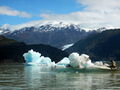
Lago Bergues y al fondo se ve el Glaciar Lucía, por Meylin Ubilla
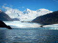
Glaciar Lucía desde el Lago Bergues, por Meylin Ubilla


Revisa la lista completa de 561 rutas de trekking y las 344 rutas de montaña en Chile
|